TIDE AND TIME
Sea Level Rise and Solastalgia on
North Carolina's Outer Banks


This story is part of the Pulitzer Center’s nationwide Connected Coastlines reporting initiative presented in partnership with CoastalReview.org.
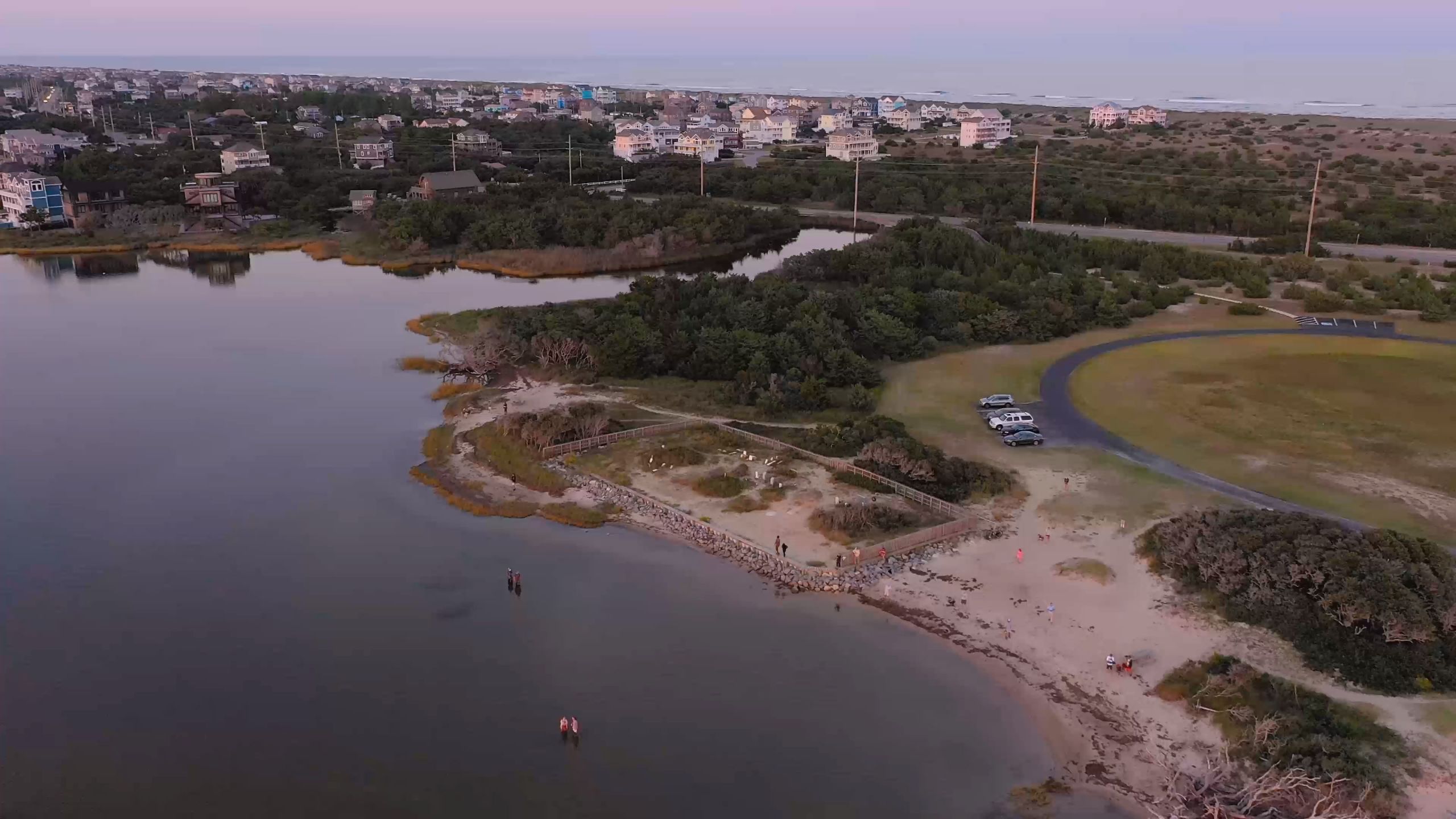
Ruby Jean Hooper’s husband, grandparents and great-grandparents are buried at the Salvo Community Cemetery, a scrubby sliver of sand on the edge of the Salvo Day Use Area on Hatteras Island, part of North Carolina’s Outer Banks. Bound by the Pamlico Sound and a parking lot, the stretch of beach is the final resting place for descendants of the first European colonists who founded the village of Salvo, where Hooper has lived all her life.
This ancestral land is sacred to Hooper, who is 85. When she dies, she still wants to be buried beside her family, even though hurricanes and tides have eroded the shoreline about 40 feet into the cemetery, smashed the graves of Dortha and Little Bannister Midgett, and washed their remains into the sound.
The day use area, a popular recreation site, was also one of Hooper’s favorite places to play as a child. She waded in the Pamlico Sound while her older brother, Earl Whidbee, who is 89, swam in Clark’s Bay to a small island that has long since eroded away. She never learned to swim but she could float on her back briefly before slipping beneath the waves. She and Earl climbed in the bushes and picked mulberries as big as her pinky and plucked figs from trees that were eventually drowned by the encroaching sound. They gathered around bonfires there at night, and she remembers how the planet Venus shimmered over the water in the west, and on a clear night the bands of the Milky Way stretched across the sky.
Today, the miles of artificial barrier dunes built to protect the beachfront homes and N.C. Highway 12 — the only road that threads the island villages — from the Atlantic Ocean impede the natural processes that build and sustain these beloved barrier islands. As a result, scientists say the banks are eroding at an alarming rate.
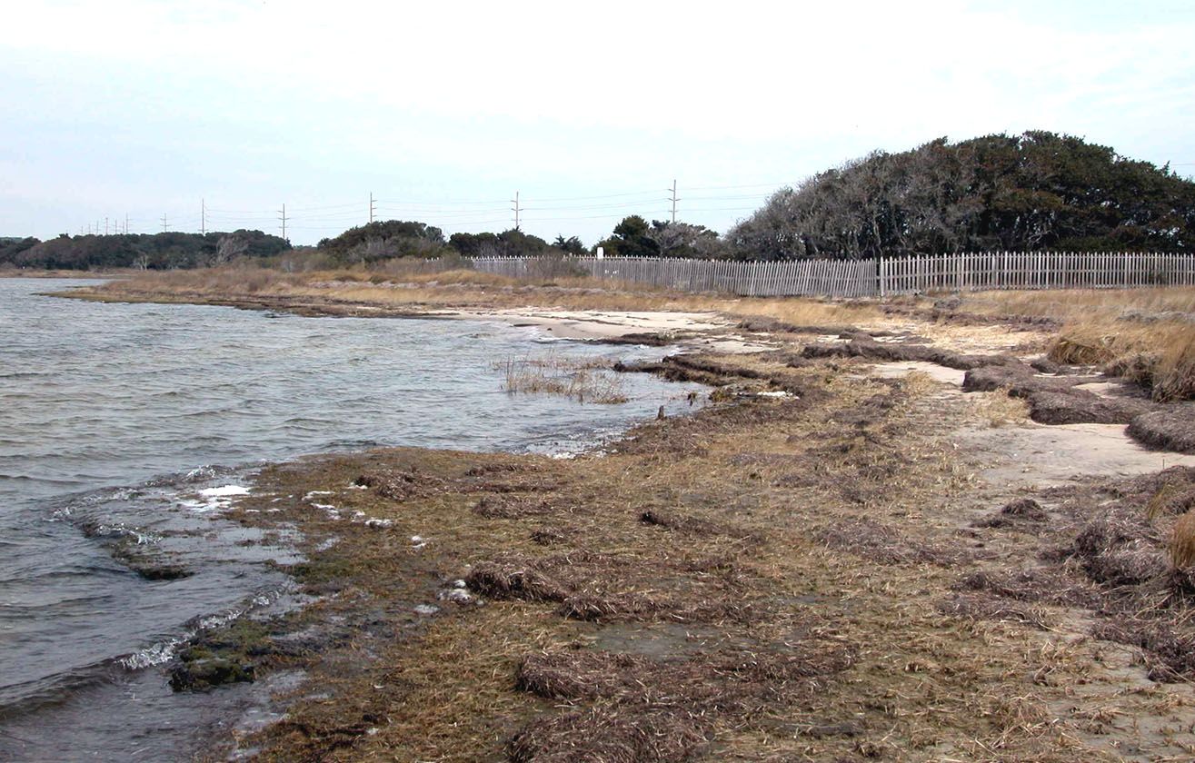
Sea level rise is exacerbating the erosion as the global climate warms. Melting glaciers and polar ice increase the oceans’ volume, and warmer ocean surface waters fuel more frequent and intense hurricanes. Data suggest the shoreline at the Salvo Day Use Area is eroding on average a foot per year since the highway was built in 1962, and likely accelerating, according to Dr. Stanley Riggs, a coastal and marine geologist at East Carolina University, and his colleagues. Today, about 25 marked graves remain of the original 32, dating back to 1872, according to descendants.
The sea is rising on the northeastern North Carolina coast at a rate of about a-foot-and-half per century, and the rise is accelerating, said Riggs. He predicts a rise between about 3 and 4 1/2 feet here by 2100.
I have been reporting and photographing this story since 2017 and have talked to more than a dozen people including residents and their extended family, government officials, historians, scientists and amateur sleuths.
As development alters the land and the island culture, as the hurricanes grow stronger and more frequent and their sacred spaces erode away, some locals say their island home feels less like home, and long for the ways they once lived more in harmony with the sea.

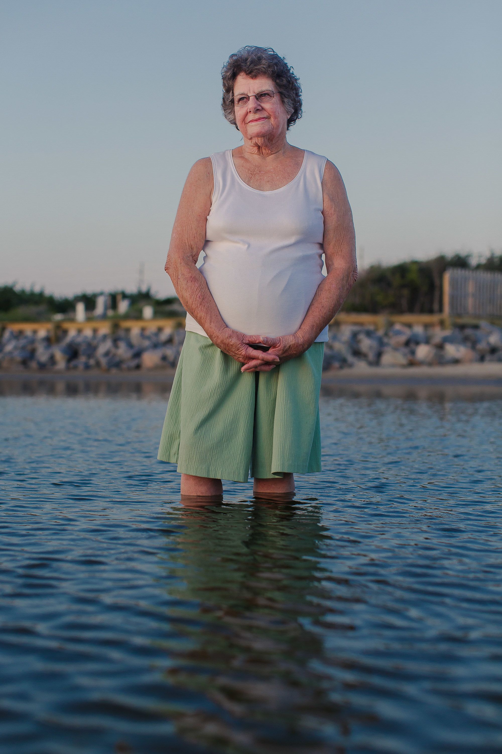
Jean Hooper posed for a portrait in the Pamlico Sound at the Salvo Community Cemetery in 2018.
Jean Hooper posed for a portrait in the Pamlico Sound at the Salvo Community Cemetery in 2018.

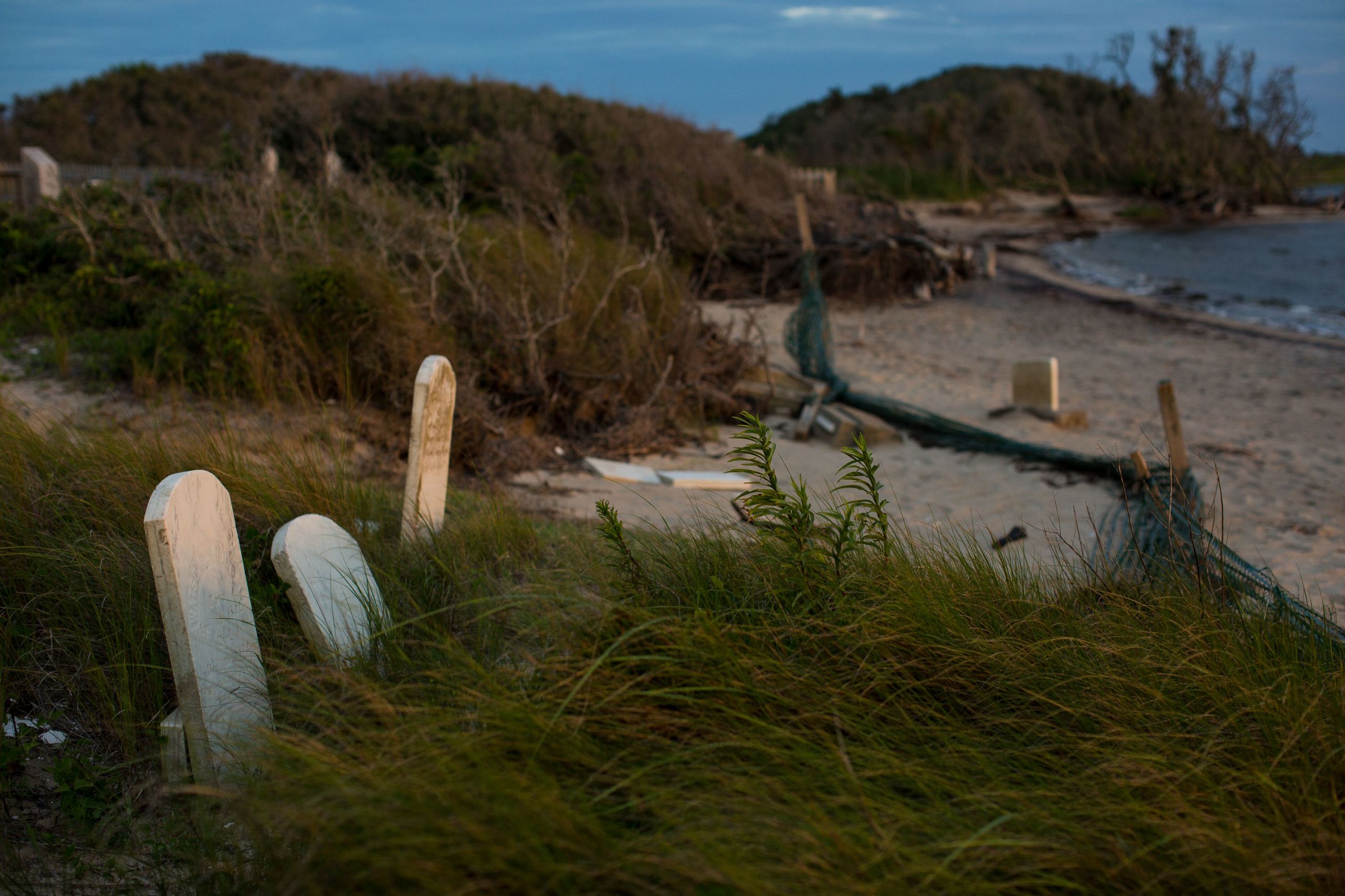
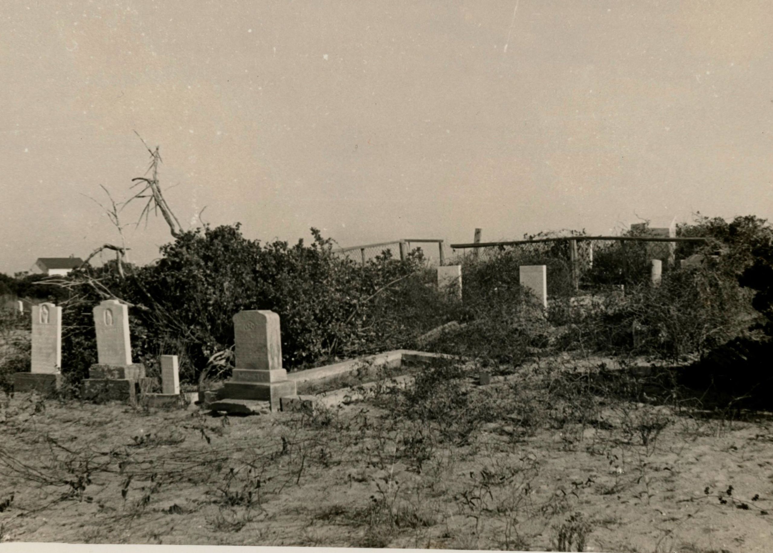
The Salvo Community Cemetery ravaged by years of erosion, June 2017. The cemetery is bound by the Pamlico Sound and the Salvo Day Use Area. Both lie within the Cape Hatteras National Seashore, which is managed by the National Park Service. But the cemetery is privately owned by the community, and not maintained by the NPS.
The Salvo Community Cemetery ravaged by years of erosion, June 2017. The cemetery is bound by the Pamlico Sound and the Salvo Day Use Area. Both lie within the Cape Hatteras National Seashore, which is managed by the National Park Service. But the cemetery is privately owned by the community, and not maintained by the NPS.
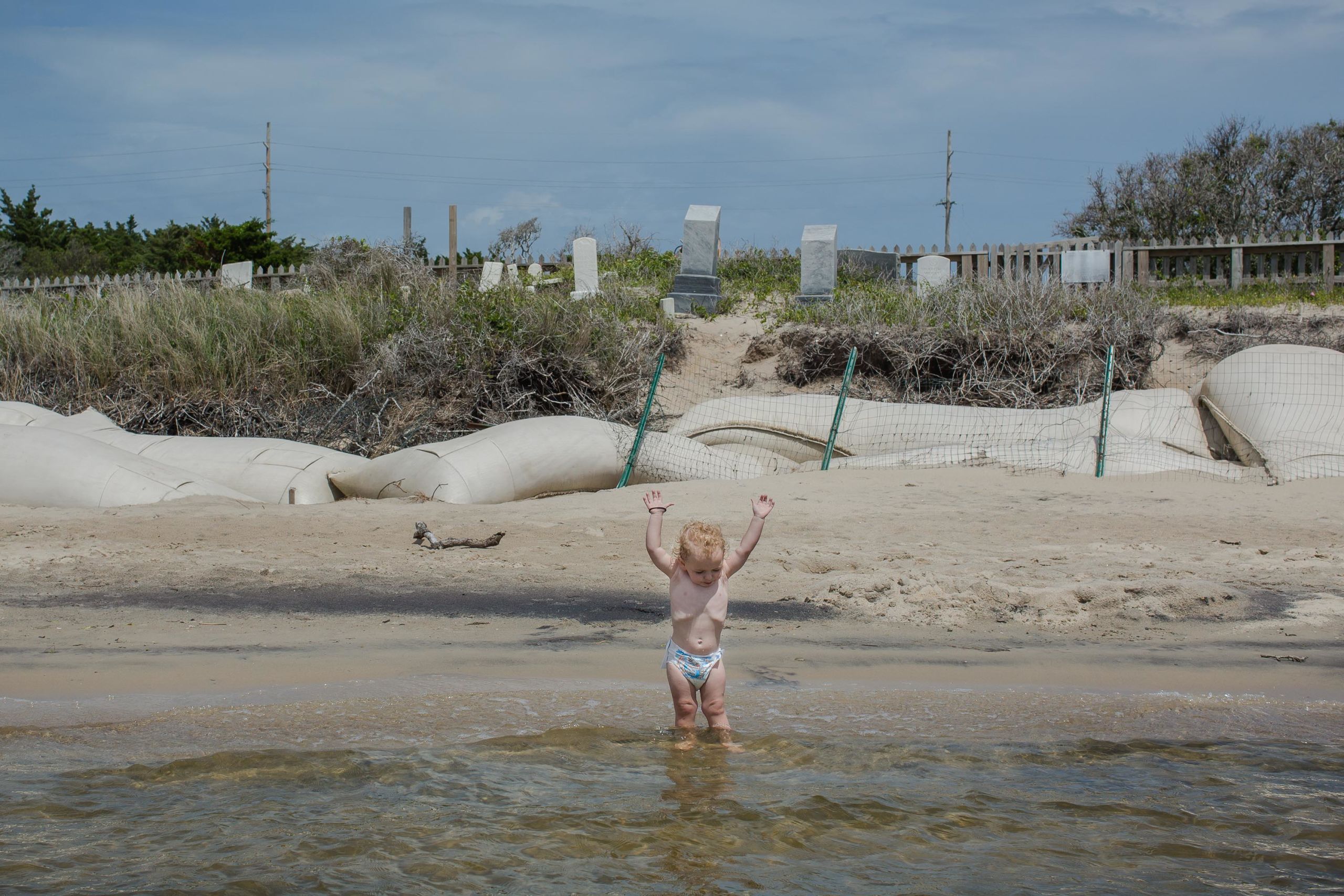
Kaine, 2, plays in the sound near sandbags installed to break waves during storms and slow erosion in the cemetery, May 2018.
Kaine, 2, plays in the sound near sandbags installed to break waves during storms and slow erosion in the cemetery, May 2018.
Large stands of wind-swept live oaks (Quercus virginiana) run parallel to the beach like tangled, twiggy cowlicks. Leafless and poisoned by saltwater intrusion as the sound creeps closer and the water table rises, many have toppled over dead.
Large stands of wind-swept live oaks (Quercus virginiana) run parallel to the beach like tangled, twiggy cowlicks. Leafless and poisoned by saltwater intrusion as the sound creeps closer and the water table rises, many have toppled over dead.
Meant to move
The Outer Banks are a low, 200-mile-long strand of barrier islands flanked by the Atlantic Ocean on one side, and on the other, large shallow sounds, into which North Carolina’s freshwater rivers empty and mix with salt water. Inlets split the islands and function as valves allowing water and sediment to flow between the ocean and the sounds during storms.
The islands are critical buffers that protect mainland North Carolina from the full force of hurricanes. They also sustain soundside estuaries and marshes teeming with migratory birds, fish, crabs, oysters, snails, bioluminescent plankton, rays, sharks, jellyfish and other wildlife. The marshes, like sponges, absorb flood waters and the force of storm waves, protecting the islands from erosion.
As the sea and the wind constantly shift and reshape these barrier islands, the only enduring thing here is change itself. Steady tides and currents give birth to new strips of land and erode them as quickly as they appear. Hurricanes and nor’easters close inlets and carve new ones through the islands which sever N.C. 12 and cut the seven Hatteras Island villages off from the mainland.
But these storms build, sustain and move the Outer Banks in a process that Riggs and his colleagues compare to the movement of a tank tread: When storm surges wash over the islands and inlets punch through them, they carpet the sound with sand where new land forms and the marshes expand. The islands naturally migrate westward toward the mainland, or at least they are supposed to.
The Outer Banks are meant to move. But instead, they are fixed in place by human intervention, and the intense storms wither the islands, until, scientists say, they will gradually be inundated. Without the Outer Banks as a buffer, hurricane storm surges will become increasingly catastrophic for mainland coastal communities and those farther inland, particularly communities of color and those with fewer resources.
Part of the crisis can be attributed to the very economic forces that have buoyed the financial health of the area. Since the 1980s, the tourism boom has opened the Outer Banks to out-of-town developers. Billions of dollars in annual revenue, aided by rapid residential and commercial development, took a string of sleepy, sparsely inhabited, white, working-class fishing villages connected by dirt roads and engorged them with investment and vacation properties that, according to census data, fill with tourists during the high season and then sit empty for the rest of the year.
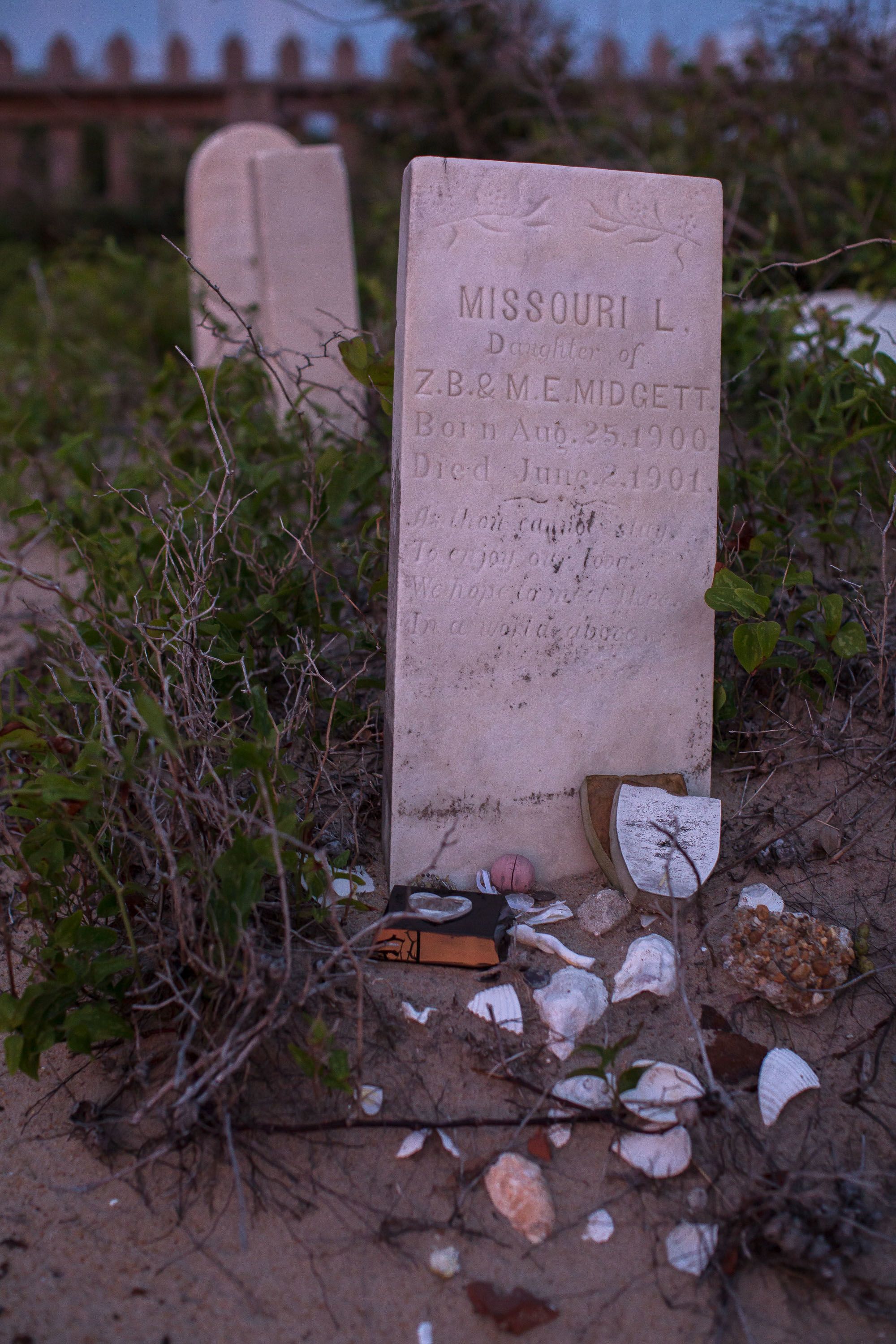
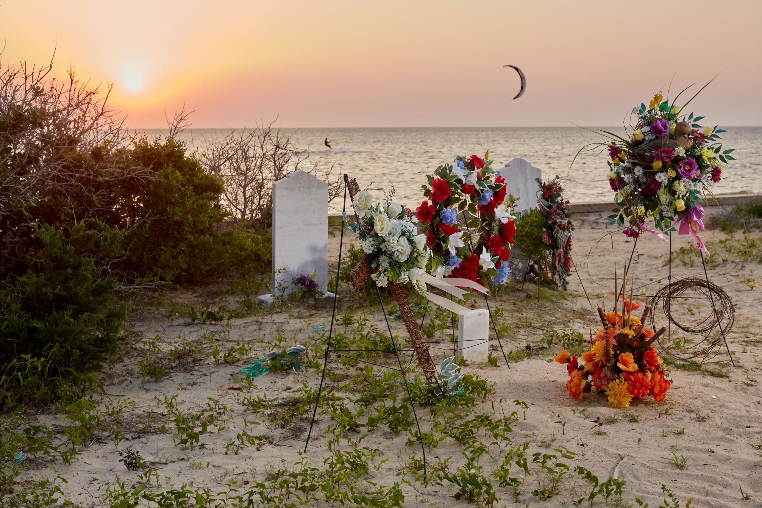
Tributes left behind on the grave of Missouri L. Midgett, who died at 10-months old in 1901.
Tributes left behind on the grave of Missouri L. Midgett, who died at 10-months old in 1901.
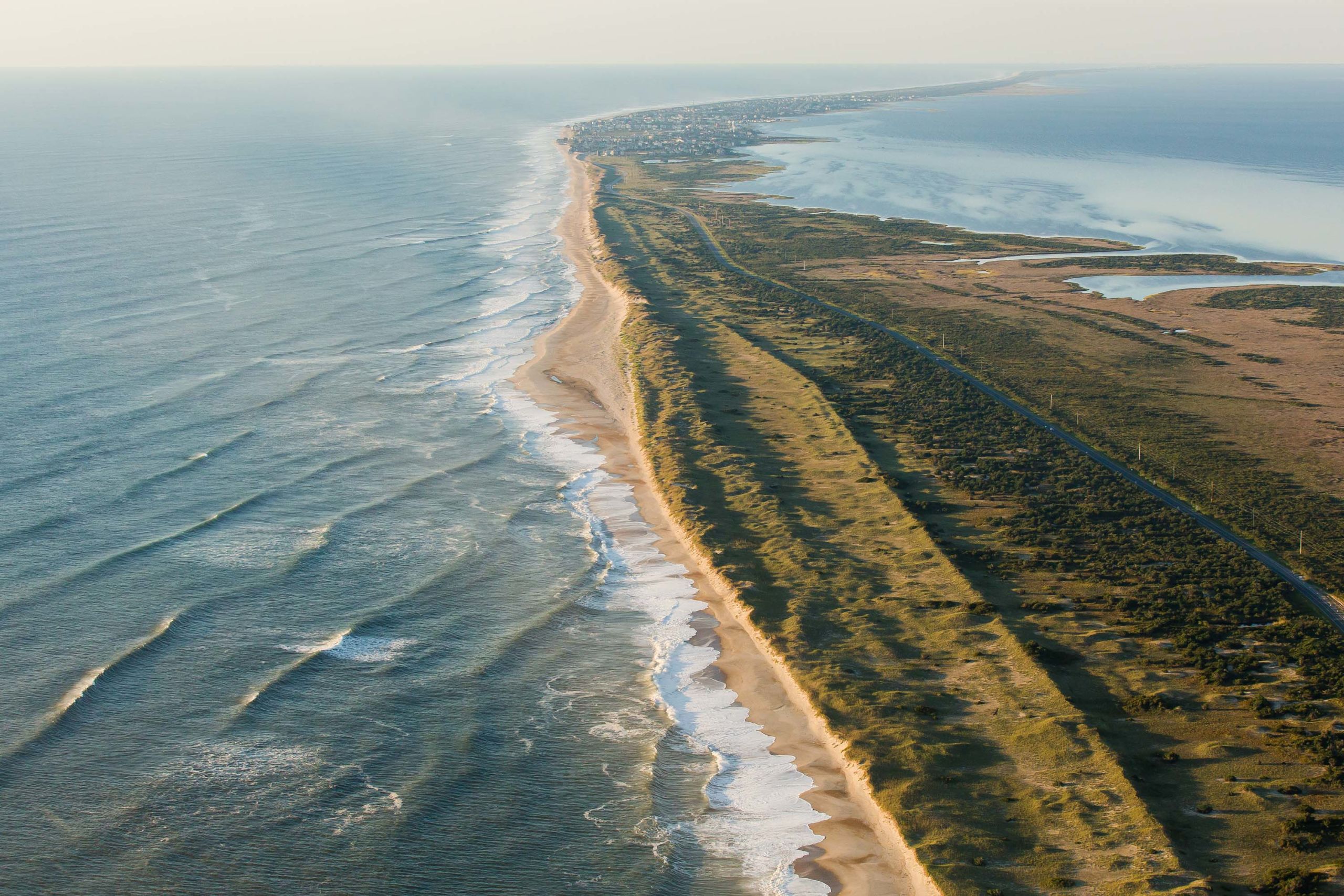
The Atlantic barrier dune ridges and N.C. Highway 12 on Pea Island looking south towards the villages of Rodanthe, Waves and Salvo.
The Atlantic barrier dune ridges and N.C. Highway 12 on Pea Island looking south towards the villages of Rodanthe, Waves and Salvo.
To protect these expensive oceanfront properties and investments, millions of dollars are spent “renourishing” the beaches with sand dredged from offshore that the next violent storm or tide just washes away. According to Riggs and other scientists, the artificial dunes that shield N.C. 12 from the Atlantic Ocean prevent the storm surge from washing sand across the island, which disrupts the migration process.
The erosion at the cemetery is representative of the problems faced on the Outer Banks. Riggs said the area was once a high sand ridge far from the sound and a major overwash plain. The beach was also naturally nourished as tides eroded the ridge into the sound, and the ocean sloshed sand across the island. But the barrier dunes have prevented the overwash, and the beach and marsh have eroded away. As the marsh disappears, he expects the erosion rates to increase. When the marsh habitat disappears so will its wildlife.
“This (cemetery) is a grand statement of how mobile this (island) system is, how incredibly dynamic it is,” said Riggs

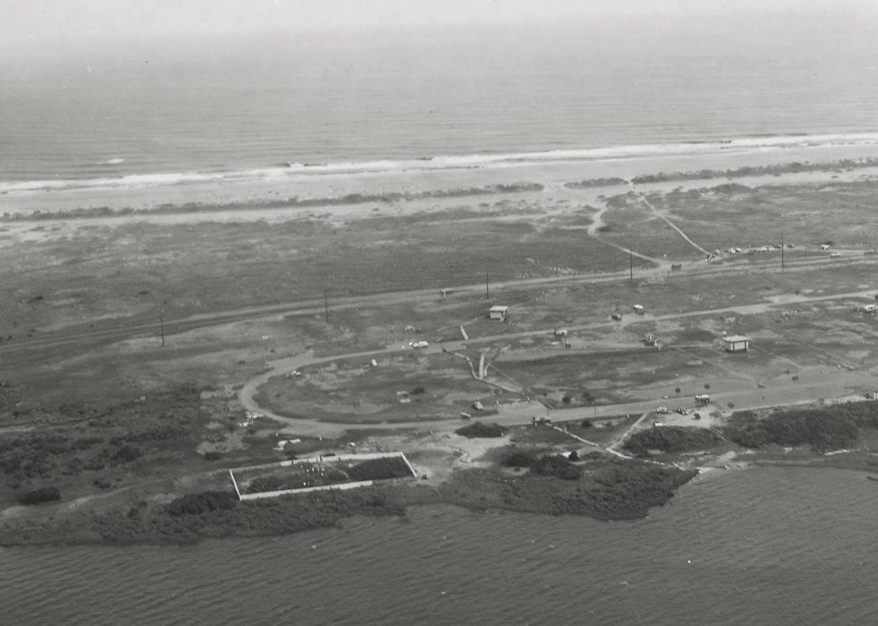
The Salvo Community Cemetery in 1970, with a complete fence and a shoreline with vegetation. Photo courtesy of National Park Service, Cape Hatteras National Seashore.
The Salvo Community Cemetery in 1970, with a complete fence and a shoreline with vegetation. Photo courtesy of National Park Service, Cape Hatteras National Seashore.
The Salvo Community Cemetery after decades of erosion, September 2017.
The Salvo Community Cemetery after decades of erosion, September 2017.
It'll all be water
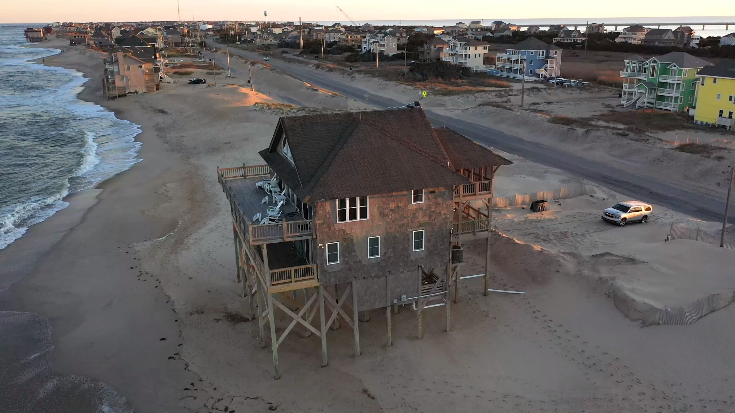
Jean Hooper lives about a mile north of the day use area in the village of Salvo, which is only 5 feet above sea level, in a squat, cozy little house that her husband Burtis, 82, built. It is surrounded by big vacation homes perched high upon pilings to keep them from flooding.
Most people in Salvo are older, with a median age of 59. Hooper, Burtis and Earl all grew up here; Jean has never lived anywhere else. She sold Avon beauty products for about 50 years, and Burtis served in the U.S. Army and worked with the North Carolina Department of Transportation. He retired as a ferry captain. Earl worked in Ohio, Virginia, Washington, D.C., and New Jersey for much of his life, but eventually moved back to Salvo in 1989 to help care for their ailing mother. He lives down the road in the house where he, Jean and their three siblings were raised.
Around noon on the first day of the Atlantic hurricane season, June 1, 2018, we gathered in her tidy kitchen. She slid some faded black and white photographs across the kitchen table. In one, a bunch of skinny kids pose at the cemetery fence. There’s Jean in the middle, 10 or 11 years old, with windswept hair, wearing a blouse and floral skirt, flanked by three of her cousins and her sister, Irene. Sol Libsohn, a photographer from the Standard Oil Photography Project, made the image as he was passing through in 1945.
In another of his photos, she and Irene arrange shells around the grave of her grandfather, Luther Gray. He is buried in the cemetery’s southeast corner beside her grandmother, Josephine Gray, who died in 1964. These photos are among her most prized possessions.

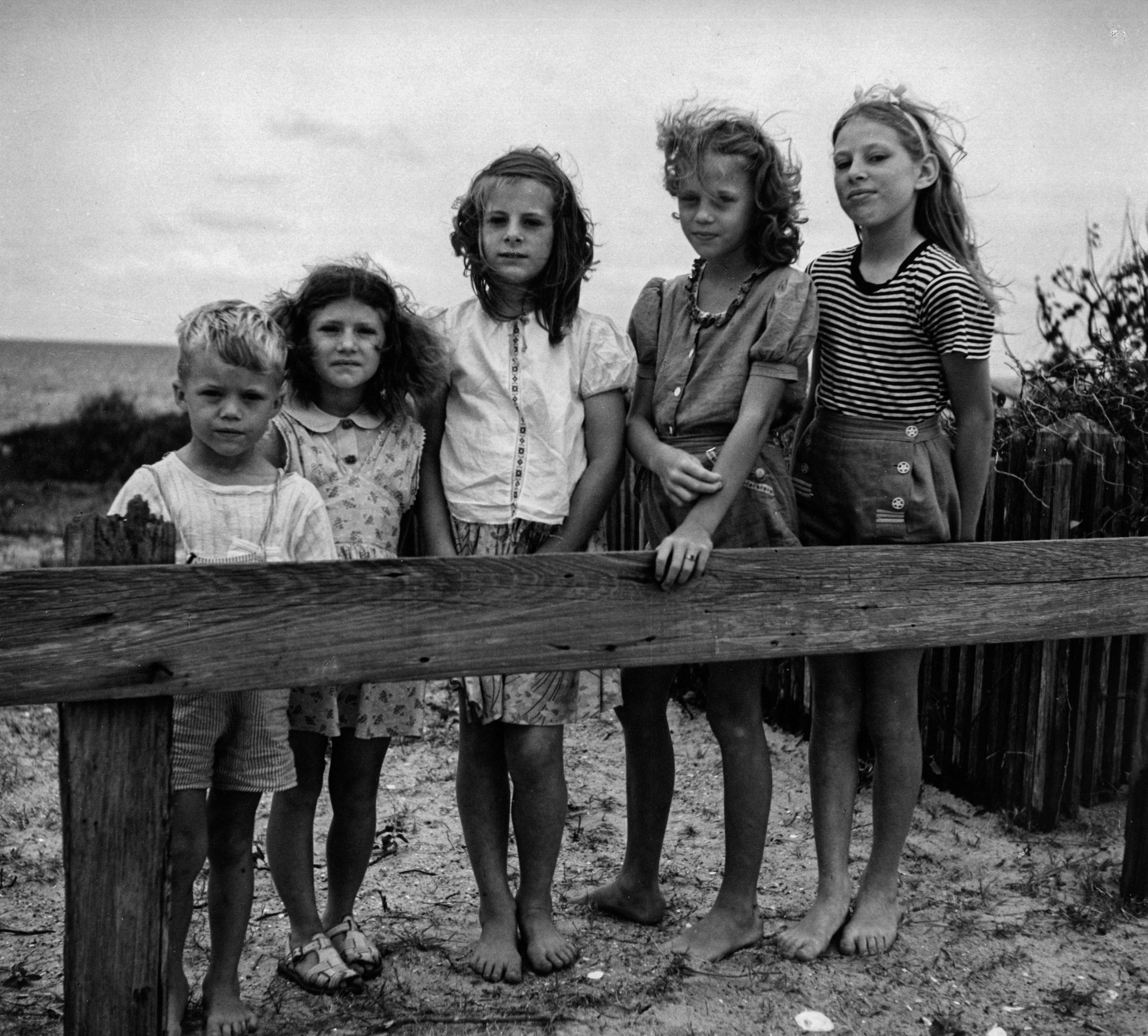
Jean Hooper (center) flanked by her cousins Cyrus Gray (far left) and Shirley Midgett Shannon (second from left), and her cousin Norma Gray Cahoon (second from right) and her sister Irene Whidbee Midgett (far right) at the cemetery in 1945. Photograph by Sol Libsohn, 1945. Image ULPA SONJ 26975, Standard Oil (New Jersey) Collection, Photographic Archives, University of Louisville, Louisville, Kentucky. Used with permission.
Jean Hooper (center) flanked by her cousins Cyrus Gray (far left) and Shirley Midgett Shannon (second from left), and her cousin Norma Gray Cahoon (second from right) and her sister Irene Whidbee Midgett (far right) at the cemetery in 1945. Photograph by Sol Libsohn, 1945. Image ULPA SONJ 26975, Standard Oil (New Jersey) Collection, Photographic Archives, University of Louisville, Louisville, Kentucky. Used with permission.
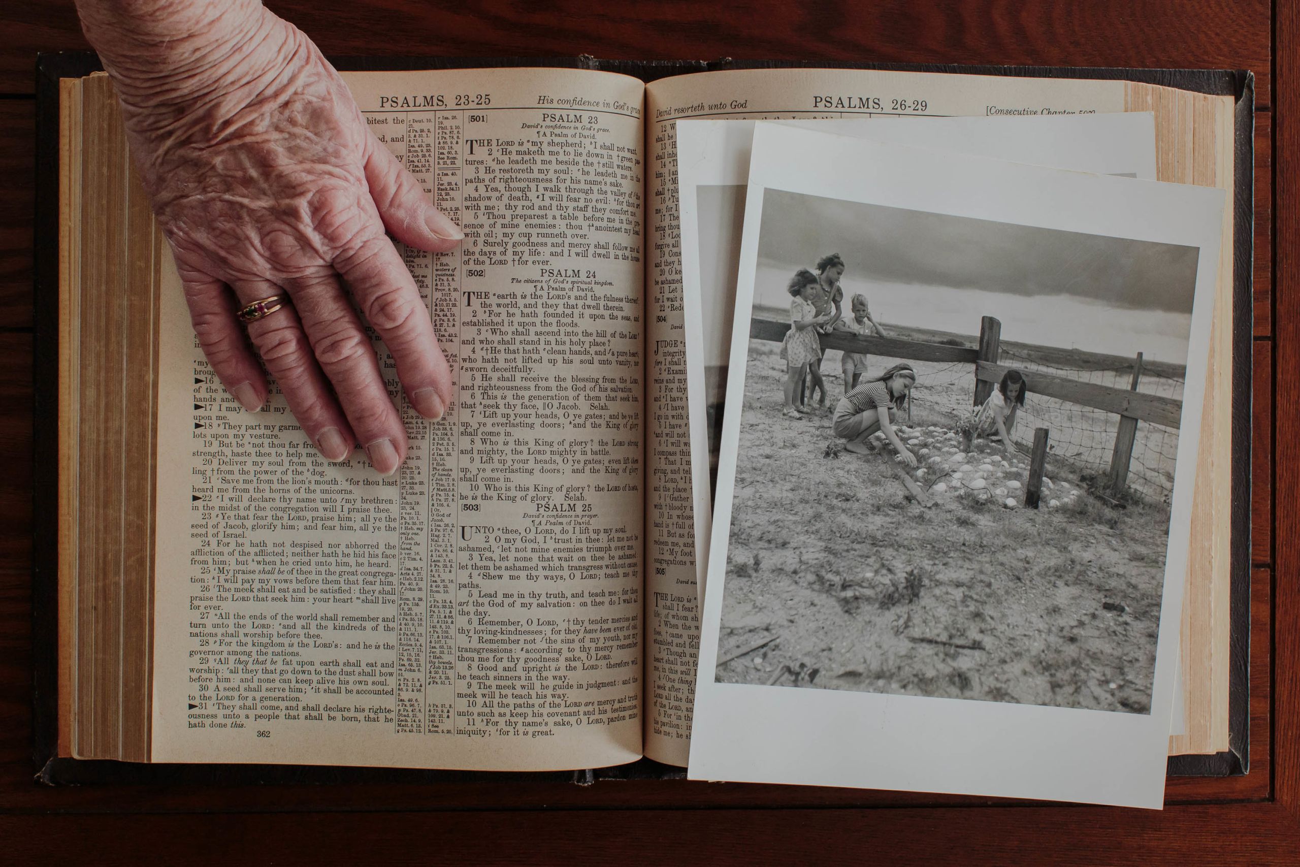
The Hooper’s lost many of their old photographs when Hurricane Irene flooded their house in 2011. Jean still has these photos of her and her sister and cousins at their grandfather’s grave at the Salvo Community Cemetery. They were made by Sol Libsohn, a photographer from the legendary Standard Oil Photography Project.
The Hooper’s lost many of their old photographs when Hurricane Irene flooded their house in 2011. Jean still has these photos of her and her sister and cousins at their grandfather’s grave at the Salvo Community Cemetery. They were made by Sol Libsohn, a photographer from the legendary Standard Oil Photography Project.
Jean has lived through so many hurricanes and nor’easters they all blur together now. They were just a part of life when she was growing up, so she is not afraid of them. When a bad storm is on the way she would rather stay with her house and all her belongings.
“The Good Lord’s going to take care of me wherever I am,” she said.
She has left the island only once before a storm, during Hurricane Gloria in 1985, because her mother relied on an oxygen tank to breathe and it was too risky for her to stay. But storm after storm brought the Pamlico Sound up into her yard, and sometimes the water got so high she could hear it sloshing around under the house all night long. She remembers two big hurricanes: The Storm of 1944 — before the National Hurricane Center named them — that blew the roof off her childhood church, which is just down the road, and Hurricane Irene in 2011. Hurricane Irene was the worst, she said.
Irene, a Category 1 storm on the Saffir-Simpson Hurricane Wind Scale, tracked west into the Pamlico Sound. It pushed the water westward into coastal rivers and bays which temporarily drained the sound near the village of Salvo. When the storm passed the water rushed back and flooded the soundside with up to 7 feet of water.
Burtis sat in a chair by the back door and watched the sound come through their backyard. It crept into the kitchen, climbed up the front porch and seeped through the front door. Eventually there was 14 inches of water in the house and nearly 4 feet of water in the yard. It ruined their kitchen appliances and smeared muck all over the floor and walls. It destroyed their cars. It covered in mold the bedroom furniture that they had bought the year they married and soaked many of their old photos. Since Irene, Jean keeps her photographs stored in plastic tote boxes so they won’t get ruined.
The Hoopers had to remodel most of the kitchen and could not live in their house for five months. They put their drowned furniture and appliances by the road. It was all hauled down to the Salvo Day Use Area and piled up with the rest of the island’s storm debris in the large grassy area in the middle of the grounds.
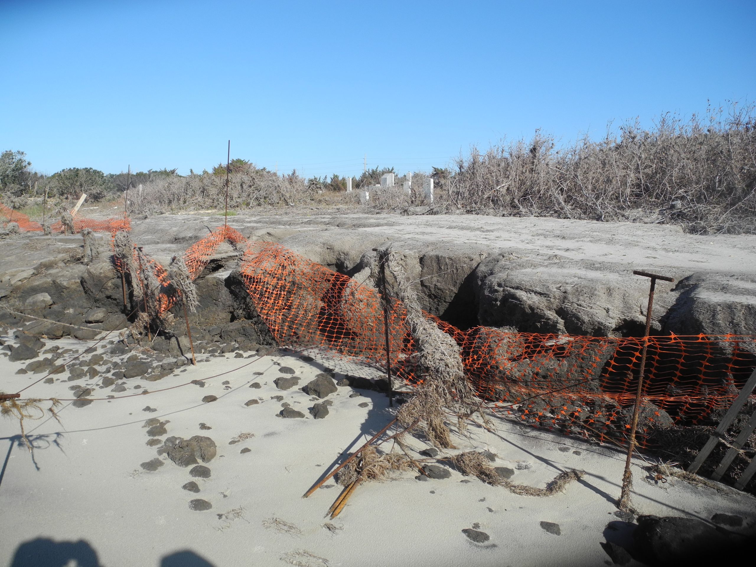
Hurricane Irene also punished the cemetery: The storm pushed the Pamlico Sound up into the graveyard, flattened the fence, rummaged through the graves, and sucked away a lot of sand when the waters receded. The process repeated in 2012 when Hurricane Sandy came through, then again with Arthur in 2014, with Matthew in 2016, and all the nor’easters in between. Tombstones were toppled over. Graves were exhumed. Burial vaults were broken apart. Some Midgetts went missing from their graves.
A few miles north of Rodanthe, Irene sliced a new inlet through Pea Island and N.C. 12, which cut off Hatteras Island from the mainland, and made it accessible only by ferry for two months.
Earl and Jean said they have noticed the ocean and the sound have gotten higher in their lifetime.
“They say in years to come this is really not going to be an island. It’ll be all water,” said Earl.
“Do you believe that?” I asked.
“I do,” he said.
“I won’t be here,” said Jean, laughing.
“And you can’t swim?” I asked her.
Jean laughed. “I can’t swim, and I won’t be here when it happens, so ... I’ll be down (in the cemetery) so, if I come up, I’ll say, “Hiiii.”
Then she waved.
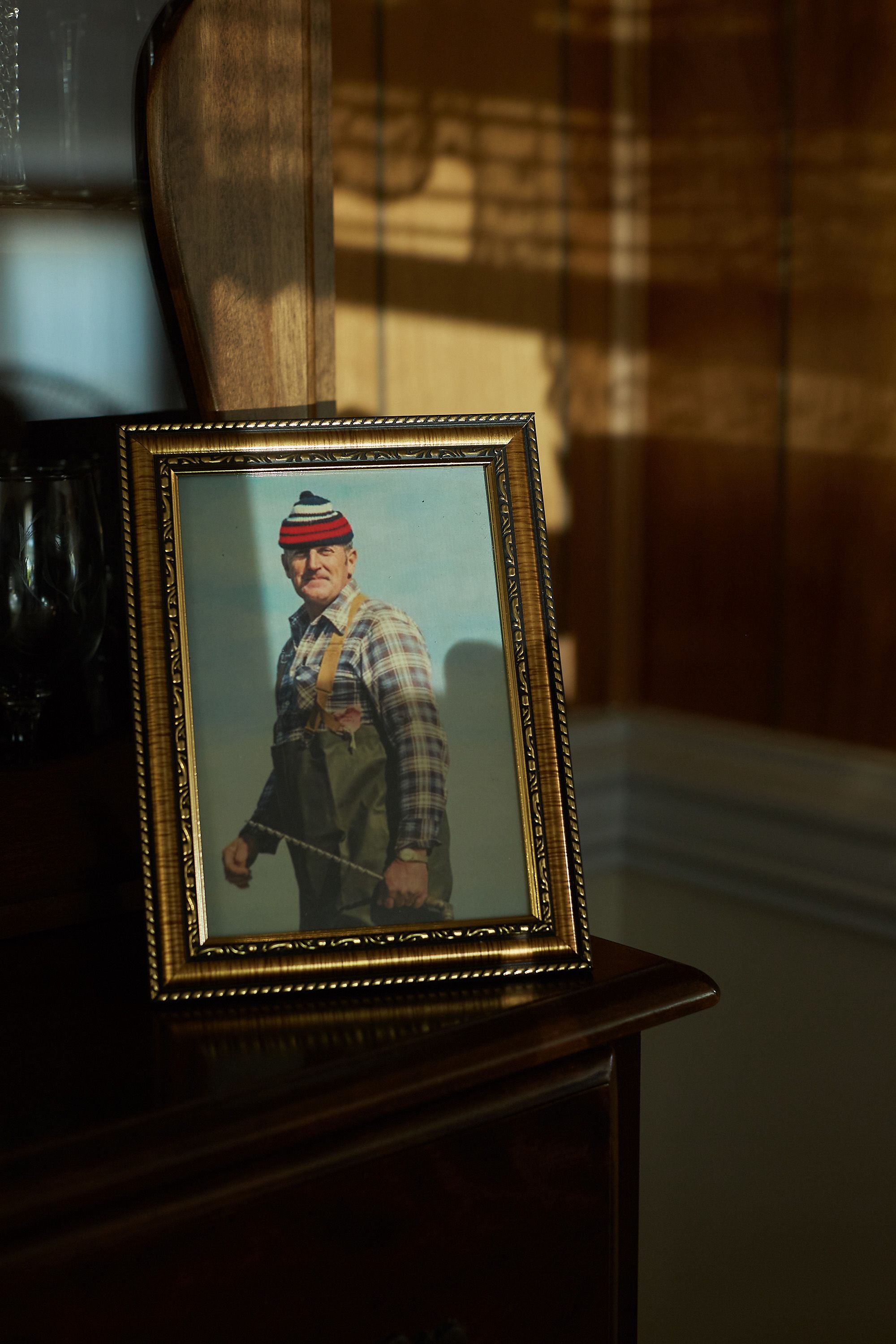
Jean’s husband, Burtis, passed away March 7, 2019 at 85 years old.
Jean’s husband, Burtis, passed away March 7, 2019 at 85 years old.
“They say in years to come this is really not going to be an island. It’ll be all water,” said Earl.
The fresh grave of Burtis Hooper in 2019. He was buried right next to Jean’s grandparents, Josephine and Luther Gray.
The fresh grave of Burtis Hooper in 2019. He was buried right next to Jean’s grandparents, Josephine and Luther Gray.
Earth’s climate has typically been hotter than it is today, and always fickle and fragile, with shifts that have caused drastic planetary changes and mass extinctions. In the last 650,000 years of the Pleistocene Epoch, the climate has endured around eight natural intermittent cold and warm cycles where glaciers have advanced and retreated due to wobbles in the Earth’s axis and orbit. Plotted on a chart, the trend line for these cycles resembles a heart monitor during a cardiac arrest. Through these glacial and interglacial periods, atmospheric carbon levels oscillated between 200 and 280 parts per million.
Human extraction and burning of fossil fuels has raised carbon dioxide levels from 280 to 414 parts per million in only the last 150 years, or in the time since the first grave was dug in the Salvo Community Cemetery in the 1870s for Watson Midgett, a Union Civil War veteran. This has caused the global climate to suddenly warm nearly 1 degree Celsius, or 1.8 degrees Fahrenheit, above pre-industrial levels, and the effects are being felt now. The last time that much carbon dioxide was in the air occurred 3 million years ago during the Pliocene Epoch when the planet was 3 to 4 degrees Celsius warmer, and sea levels were 70 to 80 feet higher. Back then, most of North Carolina east of Interstate 95 was an ocean, as indicated by all of the marine fossils only found east of an ancient shoreline known to geologists as the Suffolk Scarp.
If carbon emissions continue unabated, “global warming is likely to reach 1.5°C between 2030 and 2052,” unless immediate action is taken, according to a special 2018 Intergovernmental Panel on Climate Change report. The report predicts disaster if the planet warms beyond 2 degrees Celsius. A Washington Post special project showed that the planet is warming unevenly, and some areas have already warmed 2 degrees Celsius, or 3.6 degrees Fahrenheit.
Just 100 companies are responsible for 70% of global emissions since 1988, and the U.S. military alone has produced 1.2 billion metric tons of greenhouse gas emissions since the Global War on Terror began in 2001. Fossil fuel companies knew since 1977 that their emissions were warming the climate and spent millions sowing disinformation to deceive the public. Ordinary people have been manipulated into believing that we and our individual choices alone — not these industries or economic systems — are to blame for climate change; that it is our responsibility to deal with the environmental side effects of their carbon emissions, and that we must alter our consumption habits and reduce our individual carbon footprints to keep the world from barreling over a climate change cliff.
Earlier this year, President Biden signed an executive order that centers climate change in all U.S. national security and foreign policy, and later committed the U.S. to cutting its greenhouse emissions to at least half of 2005 levels by 2030. North Carolina’s 2020 Climate Risk Assessment and Resilience Plan prioritizes equity and climate justice; integrates climate resiliency into all agencies and long-term planning and builds interagency cooperation; and calls for the North Carolina General Assembly to raise funding for climate science specific to the state.
But North Carolina’s Republican-led legislature has a history of hamstringing science-based climate change planning. It rejected a 2012 report by the Coastal Resources Commission science panel that warned sea level could rise 39 inches on the coast by 2100 and required that future sea level rise predictions could only consider historical trends. Dr. Stanley Riggs resigned from the panel in 2016 in protest because he felt the limitations rendered the panel ineffective.
Independent of Dare County, the town of Nags Head has a mayor and town council, and implemented its own resilience plan to deal with flooding. Dare County Commissioner Danny Couch, the board’s only Democrat and only Dare County native, says a similar plan for the Hatteras Island villages that he represents is “in its infancy.”
But the process is more complicated. The island is in unincorporated Dare County, with no mayors or town councils, only civic associations. He says that makes it harder for locals to organize. Much of the land is owned by the National Park Service, the State of North Carolina, and other private groups, which poses coordination challenges. He also describes the county politics as a “blood sport” because the constituency is so tight-knit and vocal, and so many political issues on the Outer Banks—from climate change, to hurricanes, to the highway—are a hot button issue. He appreciates the bipartisan approach of his otherwise hyperpartisan board, and wants a bipartisan, science-based approach to resilience planning, but Couch said the science has to be balanced with the fact that people still have to live here. (Couch deeply respects Dr. Stanley Riggs, who was his geology professor when he was a student at East Carolina University in the early 1980s).
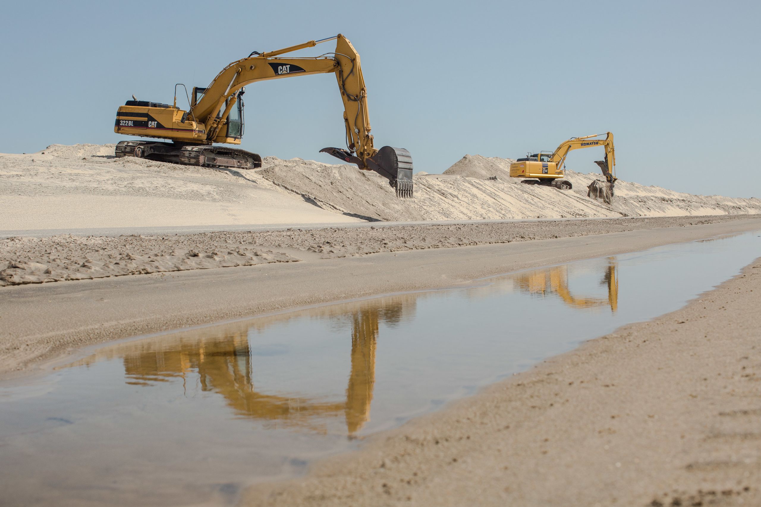
On Pea Island, bulldozers scrape sand off N.C. Highway 12 and shape it back into barrier dunes after Tropical Storm Jose breached them and washed sand into the road, September 2017.
On Pea Island, bulldozers scrape sand off N.C. Highway 12 and shape it back into barrier dunes after Tropical Storm Jose breached them and washed sand into the road, September 2017.
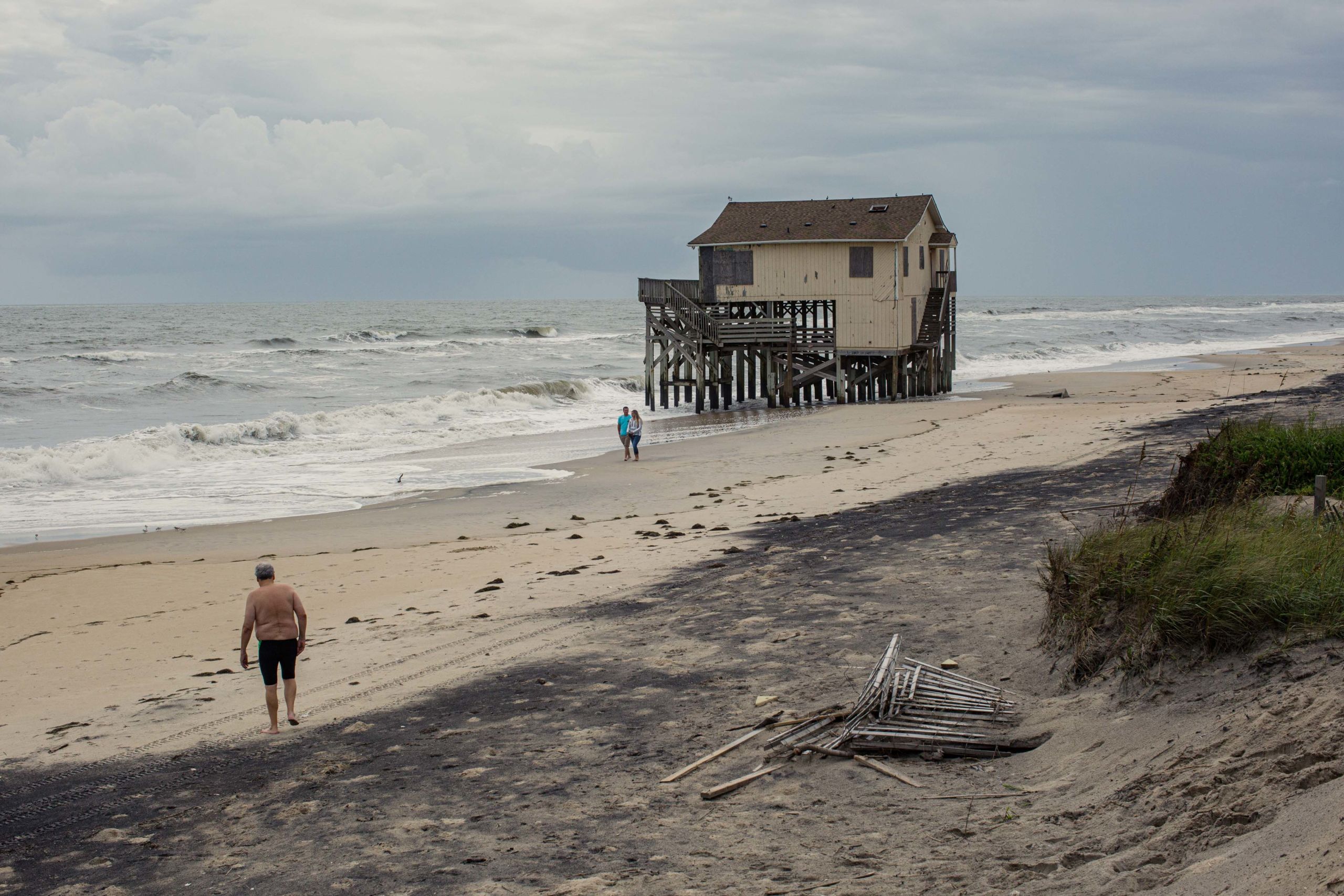
The Atlantic Ocean has washed away Seagull Drive in Nags Head, and encroached upon an abandoned home that was once on the first row of homes. Others have since been demolished.
The Atlantic Ocean has washed away Seagull Drive in Nags Head, and encroached upon an abandoned home that was once on the first row of homes. Others have since been demolished.
Dare County has taken a proactive approach to resilience planning since the 1970s, said county planning director Donna Creef, especially when it comes to using Federal Emergency Management Agency grants to elevate homes in flood zones. However, Creef said, Dare County does not have a buyout or relocation program for flood-prone properties and families who want to retreat, and the state legislation that controls beach nourishment funds prohibits them from being used for relocation.
Relocation and retreat “sounds good on paper,” Creef said, but she added that many Hatteras Island families who have lived there for generations would not want to relocate, regardless. It is not practical for many who have deep family ties to the island and investment rental properties that are a source of income.
“Where do you go?” she asked.
Meanwhile, Dare County plans to spend $99 million — the most it has ever spent — in 2022 on beach nourishment projects along its ocean shorelines from Duck to Buxton, with money from local tax districts, occupancy taxes, and state and federal funds.
In 2020, the COVID-19 pandemic brought record tourism and housing sales as tourists flocked to the Outer Banks to escape the virus. Property-owning families from out of state fled to their vacation homes indefinitely to work remotely, and other families purchased permanent residences on the islands, according to Couch, who sold some of those homes.
As more people move to the coast, resilience plans become more urgent. According to the Union of Concerned Scientists, by 2045 — in about the span of a 30-year mortgage issued today, the report noted — 311,000 American homes will be at risk of chronic flooding from sea level rise, including about 2,000 homes in Nags Head and Hatteras Island alone. North Carolina has a significant amount of “highly exposed communities with above-average poverty rates,” and flooding will inflict the greatest loss on these communities.
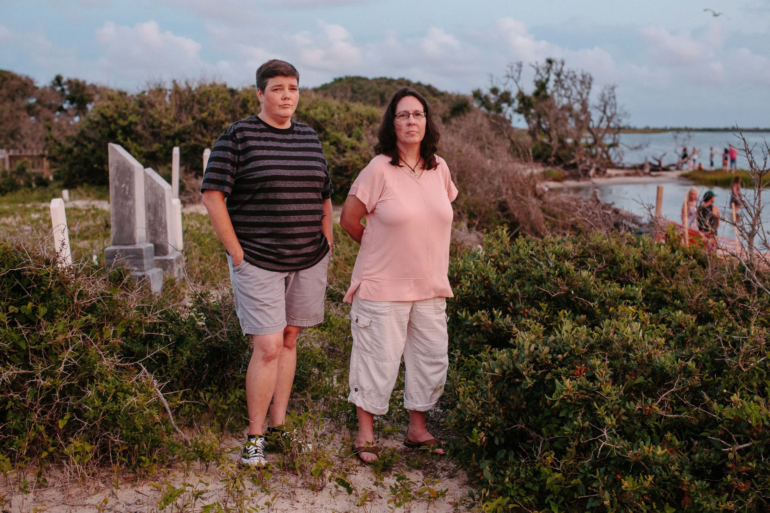
From left: Jenny Creech and Dawn Taylor both have kin buried in the Salvo Community Cemetery, where they posed for this portrait in 2017. They were president and vice president of the Hatteras Island Genealogical and Preservation Society, and the Rodanthe-Waves-Salvo Civic Association appointed Creech to coordinate with the community, and state and federal agencies to build a permanent bulkhead between the sound and the cemetery, which would slow erosion.
From left: Jenny Creech and Dawn Taylor both have kin buried in the Salvo Community Cemetery, where they posed for this portrait in 2017. They were president and vice president of the Hatteras Island Genealogical and Preservation Society, and the Rodanthe-Waves-Salvo Civic Association appointed Creech to coordinate with the community, and state and federal agencies to build a permanent bulkhead between the sound and the cemetery, which would slow erosion.
Bones on the beach
Jenny Farrow Creech and Dawn Farrow Taylor grew up on the Outer Banks and revere the ways the sea and their ancestors have shaped their island culture. Both have ancestors buried at the Salvo Community Cemetery.
“People don’t live their whole lives just to be forgotten when they are buried. The people down here were a very hardy lot. They made this island what it is. They are our history,” said Taylor.
In 2017 and 2018 the Hatteras Island Genealogical and Preservation Society and the Rodanthe-Waves-Salvo Civic Association, coordinated by Creech and Taylor, and a coalition of genealogy geeks and writers, history buffs, politicians, lawyers, and construction crews rallied to raise the money and save the cemetery themselves. Through donations, potlucks and chili dinners at the local fire station in 2017 and 2018 they raised about $7,000 of the estimated $150,000 needed to mitigate the erosion. Creech organized contractors and obtained permits to install emergency sandbags along the beach in case “the big one comes.” But sandbags are temporary, and a bulkhead would only slow or redirect erosion according to Riggs.
Creech and Taylor are sober to these facts. “Even when the scientific data is there, you’re still hoping you can preserve it because they are your people,” Taylor said.
Creech, 47, grew up in Buxton and works for an island real estate rental company, but previously worked in law enforcement. The cemetery has long been her peaceful place to sit and think when she was having a bad day, especially when she first became interested in genealogy. She feels a “residual energy” from the old homestead and lifesaving station that were once there. There, she always felt like someone was with her, but not in a “creepy way.”
A 5-foot, 2-inch walking encyclopedia of Hatteras Island history, Taylor, 53, grew up in Avon and Virginia Beach, Va., born to a family of Coast Guard lifesavers and lighthouse keepers. She runs a grave preservation and cleaning service, and she’s also an amateur genealogist adept at tracing her bloodline through the other families on the islands. So adept, in fact, she traced my genealogy through my maternal grandfather, William Albert Best Jr., who was from mainland Stumpy Point just across the Pamlico Sound, back to the Salvo Community Cemetery. Taylor suspects that she and Creech and I share a common relative in the cemetery: Dortha B. Midgett. Dortha, 1828-1901, and her husband Little Bannister Midgett, 1825-1895, were Taylor’s great-great-great aunt and uncle, and Creech’s great-great-great grandparents. But their graves and caskets are gone, sucked away into the Pamlico Sound by storm surge.
“I know this sounds morbid, but they are forever finding bones that look human out there in the sound,” Taylor said.

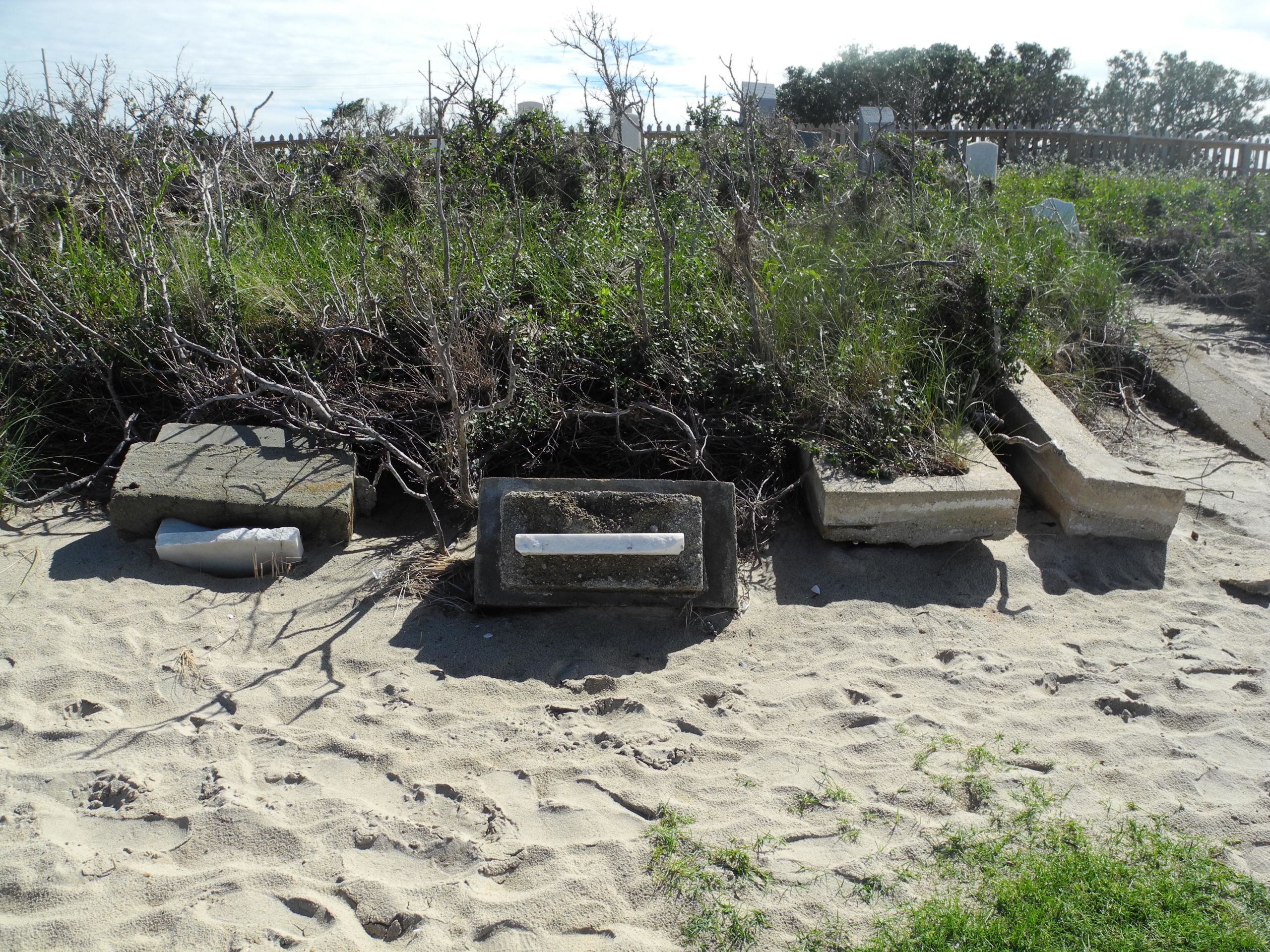
An undated photo of the graves of Dortha and Little Bannister Midgett, far left, before they were washed away. To their right are the graves of an infant child and Oliver Gilbert Midgett, both of which were exhumed and reinterred in Manteo, according to descendants. Photo courtesy of National Park Service, Cape Hatteras National Seashore.
An undated photo of the graves of Dortha and Little Bannister Midgett, far left, before they were washed away. To their right are the graves of an infant child and Oliver Gilbert Midgett, both of which were exhumed and reinterred in Manteo, according to descendants. Photo courtesy of National Park Service, Cape Hatteras National Seashore.
I met them in a Facebook group they moderated for their preservation society, where distant kin scattered around the country meet and discover how they are related. The members share the results of DNA tests, census and marriage records, obituaries, photos and memories of their ancestors. It feels like a social media family reunion.
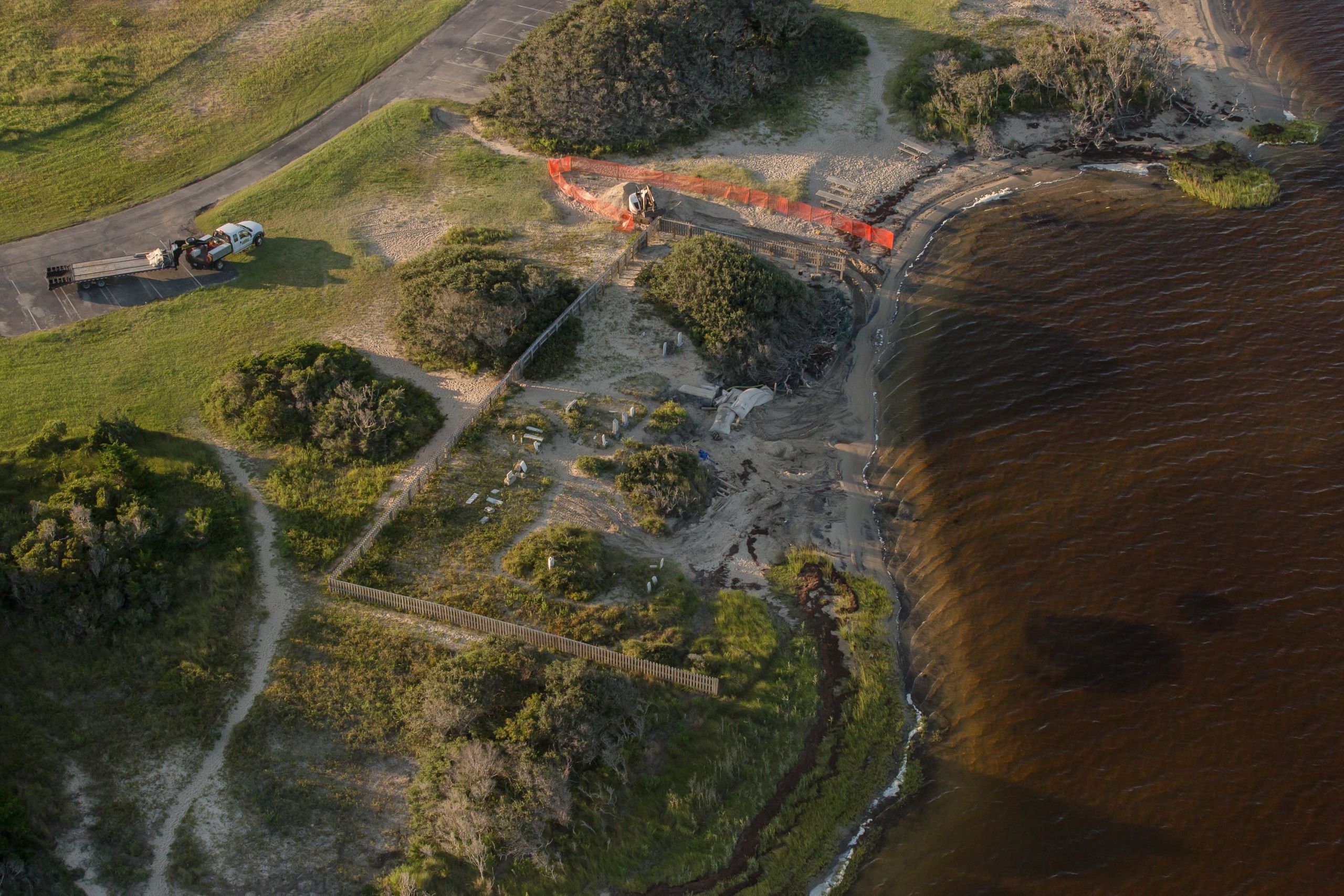
Over the last decade, the civic association collaborated with the National Park Service, the Dare County Board of Commissioners, the county office of emergency management, the North Carolina Division of Coastal Management and local engineers to find ways to slow the erosion. They researched building a living shoreline, which can consist of an oyster bed and plants, but so many waders and kite surfers use the recreation area that Creech worried that oysters could cut up their feet. To refill the cemetery with sand and build a vinyl bulkhead buffered by boulders, Dare County applied for and received a $162,000 grant from the Hurricane Matthew Disaster and Recovery Act of 2016, which earmarked money for cemeteries damaged in the storm.
In September 2017, Hurricane Irma’s uncertain path triggered Creech to have a crew install 5,000-pound emergency sandbags at the cemetery to hold back any storm surge. The genealogy geeks got their grant from Dare County, and by May 2018 a bulkhead built to protect the cemetery. It has thwarted the sound repeatedly during numerous nor’easters and hurricanes since, including two big storms, Hurricanes Florence in 2018 and Dorian in 2019. But the bulkhead will not stop the rising seas.
The only permanent solution, and an expensive one, would be to move the cemetery. Dave Hallac, superintendent of the Cape Hatteras National Seashore, collaborated closely with the preservation efforts and said that the National Park Service offered to exchange land with the Salvo community and move the cemetery closer to the highway. But many of the older descendants believe their ancestors wanted to be washed out to sea, he said.
“It’s romantic unless you have to be the guy who has to manage the bones on the beach,” Hallac said.
“This [cemetery] is a grand statement of how mobile this [island] system is, how incredibly dynamic it is,” said Dr. Riggs.

The Salvo Community Cemetery in 2003 before the marsh was completely eroded. Photo courtesy of Dr. Stanley Riggs, coastal and marine geologist at East Carolina University.
The Salvo Community Cemetery in 2003 before the marsh was completely eroded. Photo courtesy of Dr. Stanley Riggs, coastal and marine geologist at East Carolina University.

The Salvo Community Cemetery in December 2011 after it was badly damaged by Hurricane Irene in August. Photo courtesy of Dr. Stanley Riggs.
The Salvo Community Cemetery in December 2011 after it was badly damaged by Hurricane Irene in August. Photo courtesy of Dr. Stanley Riggs.
The exposed graves of Dortha and Little Bannister Midgett in September 2014 after Hurricane Arthur hit the Outer Banks in July. Photo courtesy of Dr. Stanley Riggs.
The exposed graves of Dortha and Little Bannister Midgett in September 2014 after Hurricane Arthur hit the Outer Banks in July. Photo courtesy of Dr. Stanley Riggs.
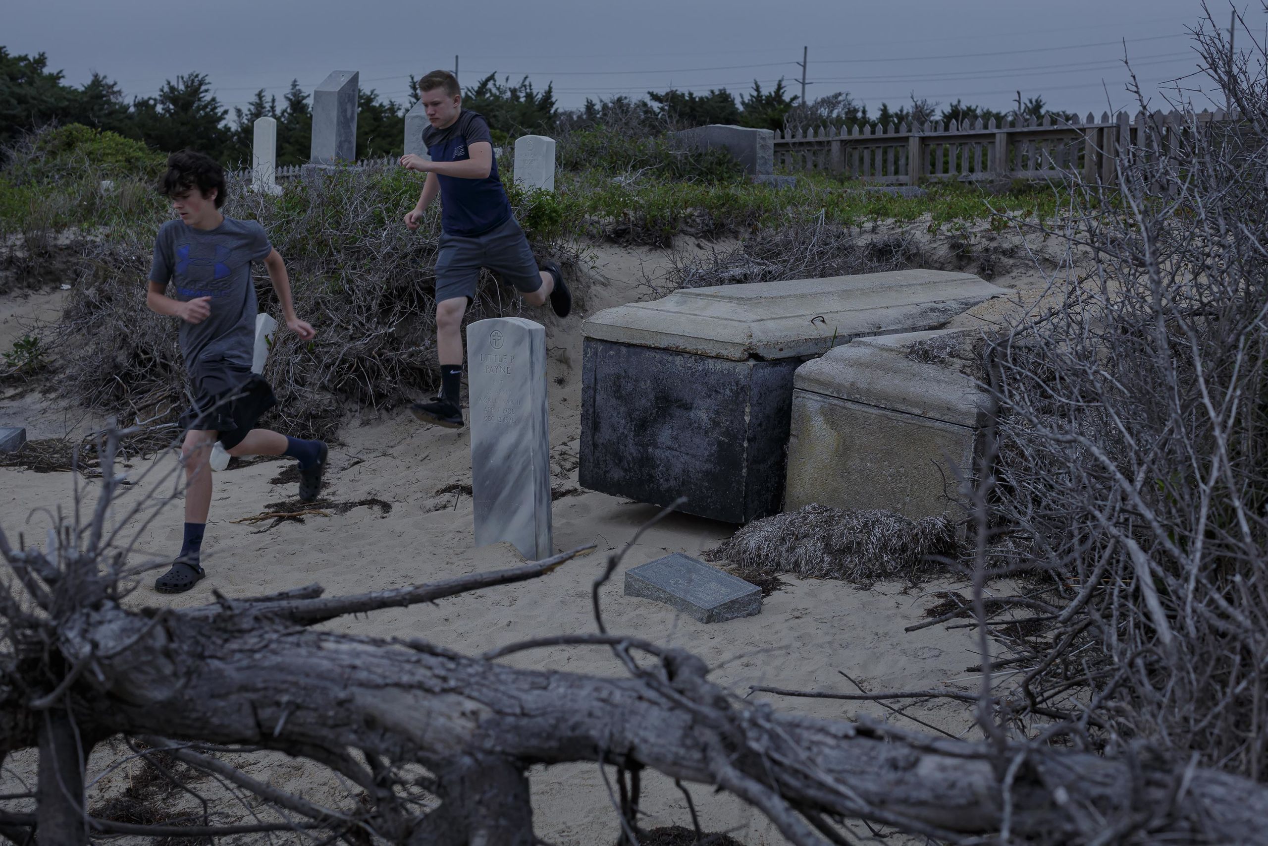
In May 2017, tourists ran past the graves of Little Pharaoh Payne, a WWII veteran, and his wife, Hilda, which had been exhumed by storm surge. The plot is also vulnerable to foot traffic, which wears away the sand banks. Cemeteries are sacred places to many Outer Banks locals, who get frustrated when tourists don’t respect the resting place of their ancestors.
In May 2017, tourists ran past the graves of Little Pharaoh Payne, a WWII veteran, and his wife, Hilda, which had been exhumed by storm surge. The plot is also vulnerable to foot traffic, which wears away the sand banks. Cemeteries are sacred places to many Outer Banks locals, who get frustrated when tourists don’t respect the resting place of their ancestors.


Tourists fish at sunset by the newly completed bulkhead at the Salvo Community Cemetery in May 2019. In 2018, Dare County was awarded a grant for $162,000 from funds left over from Hurricane Matthew emergency relief bill which was used to build the bulkhead.
Tourists fish at sunset by the newly completed bulkhead at the Salvo Community Cemetery in May 2019. In 2018, Dare County was awarded a grant for $162,000 from funds left over from Hurricane Matthew emergency relief bill which was used to build the bulkhead.

Around 6 p.m. on summer evenings, the Salvo Day Use Area empties as the kite boarders and kayakers load up and leave for dinner. As the daylight begins to fade around 8 p.m., cars fill the parking lot again. The tourists scurry down to the shoreline like gazelles herding to a wet spot on a savannah. They take in the sunset through their iPhones and wade out into the sound and pose for selfies.
Around 6 p.m. on summer evenings, the Salvo Day Use Area empties as the kite boarders and kayakers load up and leave for dinner. As the daylight begins to fade around 8 p.m., cars fill the parking lot again. The tourists scurry down to the shoreline like gazelles herding to a wet spot on a savannah. They take in the sunset through their iPhones and wade out into the sound and pose for selfies.
Solastalgia
Year after year, hurricane season brings anticipation and anxiety to the Outer Banks, and that anxiety is rising as the storms become more frequent, weaken more slowly after landfall, and the cleanup and recovery becomes more costly, time consuming, and emotionally exhausting. Before each storm Creech and Taylor worry about preparation and safety. “And then once (the storm) passes comes the cleanup, and you’re already tired and stressed from waiting for it, and doin’ the prep work,” said Taylor.
Even without a storm, “sunny day flooding” caused by a high tide aided only by wind or an offshore low-pressure system often disrupts their daily lives. Taylor is frustrated by climate change deniers who think scientists are just making it up.
“I see it. I see it every time a storm and the ocean, you know, is on (N.C.) 12. I feel like I could go fishin’ on Highway 12 now.” She laughed.
There is a word for what Jenny Creech, Dawn Taylor and other Outer Banks locals are feeling: solastalgia.
Philosopher Glenn Albrecht defined it as a sense of loss, homesickness and distress specifically caused by environmental change around someone’s home and a sense of powerlessness over that change. Though Creech was not aware of the term at the time, she said that it is “absolutely” a driving factor in her desire to preserve the cemetery.
Taylor agreed.
Dr. Susan Clayton, the psychology department chair at The College of Wooster in Ohio, and co-author of a 2017 American Psychological Association report about mental health impacts of climate change, said “relationships with place can be as significant as relationships to people,” and that “losing a family homestead can be like losing a family member.” Loss of place can lead to a loss of culture and identity.
Clayton said that burying our ancestors in the ground creates roots to land and community. When their bodies are washed out to sea it literally erodes a physical connection to place. It can make relatives wonder “What’s next? In what other ways am I gonna be ripped away from this place?” she said.
Like the effects of climate change, feelings of solastalgia and other climate anxieties can creep into our lives, making them hard to articulate if people are not conscious of climate impacts on their surroundings, according to the report.
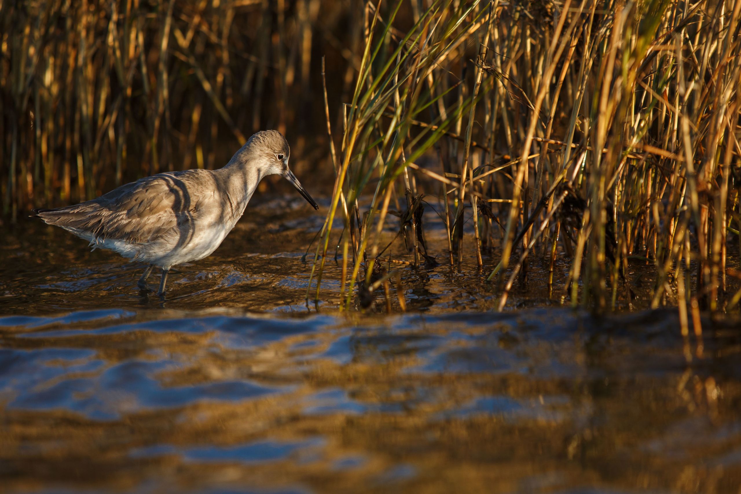
A species of sandpiper known as a Willet (Tringa semipalmata) searches for prey in the balding marsh grass at the edge of the cemetery. Willets are climate-endangered according to the National Audubon Society.
A species of sandpiper known as a Willet (Tringa semipalmata) searches for prey in the balding marsh grass at the edge of the cemetery. Willets are climate-endangered according to the National Audubon Society.
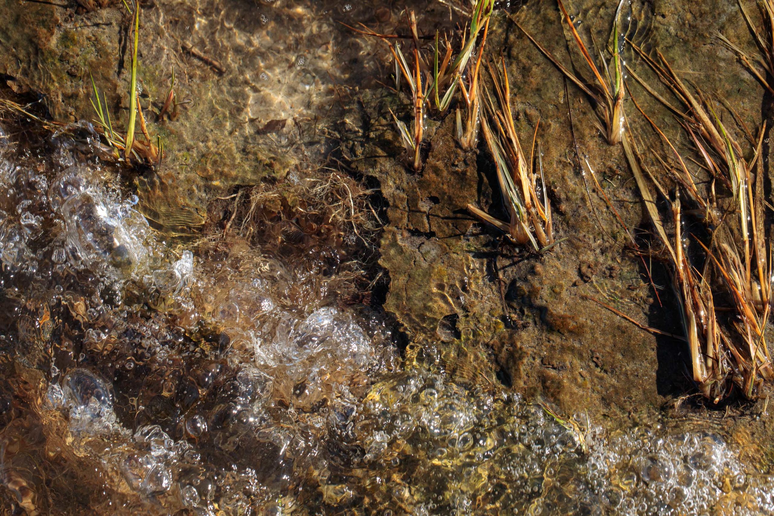
The roots of dying spartina marsh grass are exposed as the last remnants of marsh erode into the Pamlico Sound. According to the book Rising by Elizabeth Rush, though coastal marshes and other wetlands only cover 5 percent of the planet’s land, they store a quarter of the carbon found in the earth’s soil, and a healthy acre of coastal marsh can clean more carbon out of the air than an acre of Amazon. When a marsh erodes and dies from saltwater intrusion, its root system will rot and release back into the atmosphere the gases it once sequestered, including carbon dioxide and methane, contributing to climate change.
The roots of dying spartina marsh grass are exposed as the last remnants of marsh erode into the Pamlico Sound. According to the book Rising by Elizabeth Rush, though coastal marshes and other wetlands only cover 5 percent of the planet’s land, they store a quarter of the carbon found in the earth’s soil, and a healthy acre of coastal marsh can clean more carbon out of the air than an acre of Amazon. When a marsh erodes and dies from saltwater intrusion, its root system will rot and release back into the atmosphere the gases it once sequestered, including carbon dioxide and methane, contributing to climate change.
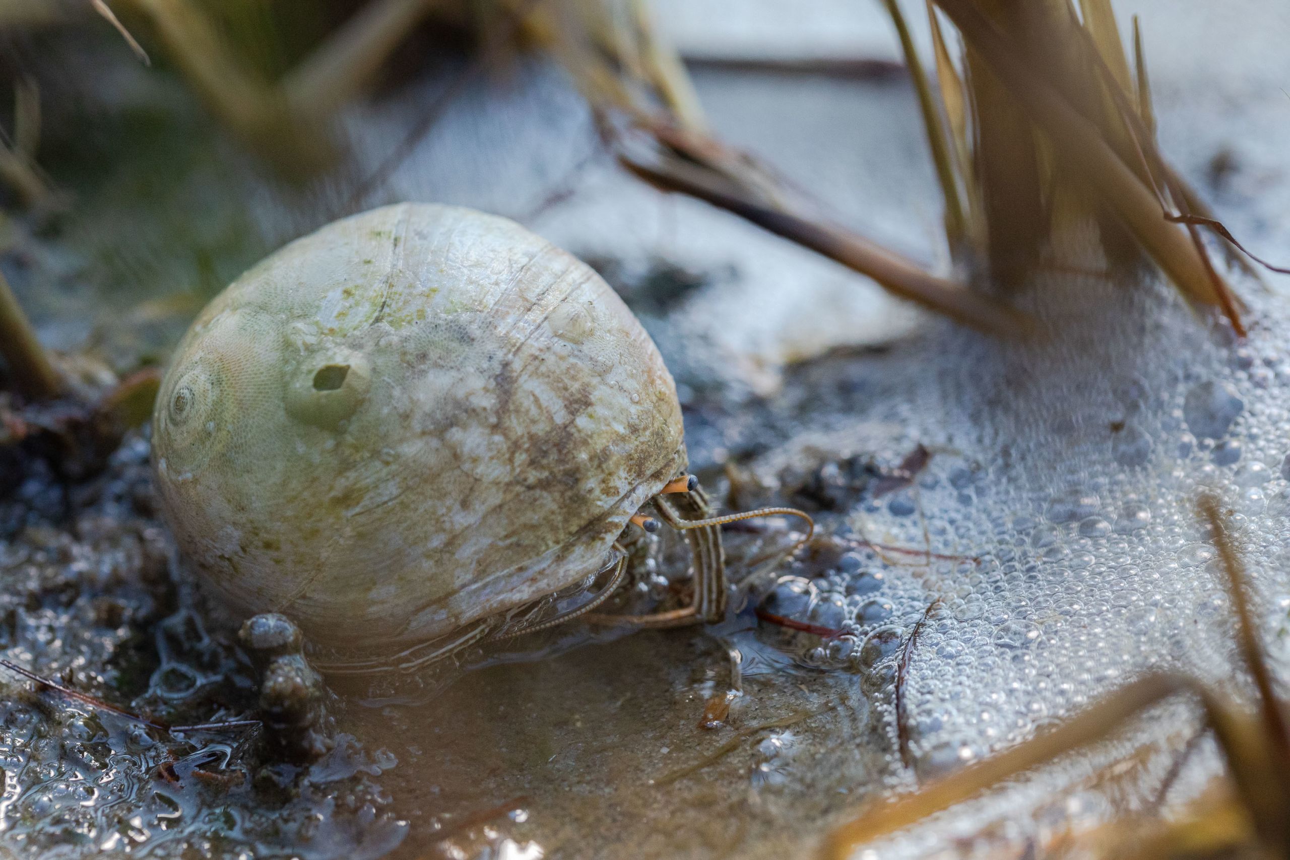
A hermit crab made a home in a snail shell in the marsh at the Salvo Day Use Area.
A hermit crab made a home in a snail shell in the marsh at the Salvo Day Use Area.
Clayton suggests that a certain amount of climate anxiety is helpful as a motivator. She recommends that folks should learn as much as possible about the immediate impacts of the climate crisis on their community, to better understand it. Next, they should be proactive in their daily lives, such as preparing their home, or by taking other actions within their means that reduce their carbon footprint.
Most important, they should organize with others who share their concerns, she said. Organizing creates community and can reduce feelings of loneliness and helplessness. “It’s usually a fairly positive experience to be with other people who share our interests even if the interest concerns something scary,” she said. They can become involved in local politics, or transform their anger, anxiety and grief into action against the economic systems and the fossil fuel companies that are most responsible for climate change.
Creech said her anxiety and sense of loss are born from the rapid unsustainable development on the Outer Banks as much as from the storms or erosive effects of the sea. Taylor agreed. Often, it is the little things they miss most. Creech misses all the trees that she used to see when she drove from one end of the island to the other, but many have been cut down to clear space for expensive vacation homes (trees are natural windbreaks that prevent erosion). She misses the solitude she once experienced on hikes, at the beach or at soundside spots. Houses stand there now, or the areas are crowded with tourists.
Worse, many of the tourists do not understand the ocean and come unprepared to deal with flooding when a storm or a strong tide breaches the barrier dunes.
“They want to come down, they want to stay, and it’s, like, ‘You may not get off the island. You may not be able to go to the store to get groceries for your family while you’re here,” Taylor said.
There are only a few grocery stores on the island, and she said the locals must compete with the tourists for already scarce supplies.
However, Creech and Taylor also see tourists as potential allies, and believe that if only the vacationers understood the Outer Banks culture they would work with the locals to preserve it.
Creech also fears her livelihood has become so inextricably linked to the tourism industry that she feels has made her home unrecognizable. As erosion chews through the beachfront rental houses that her employer manages, and, in turn, the company’s revenue and her income, she wonders: "Is this the place where I want to, or even will be able to, retire?" Overall, her island home does not bring her the same sense of peace that it once did.

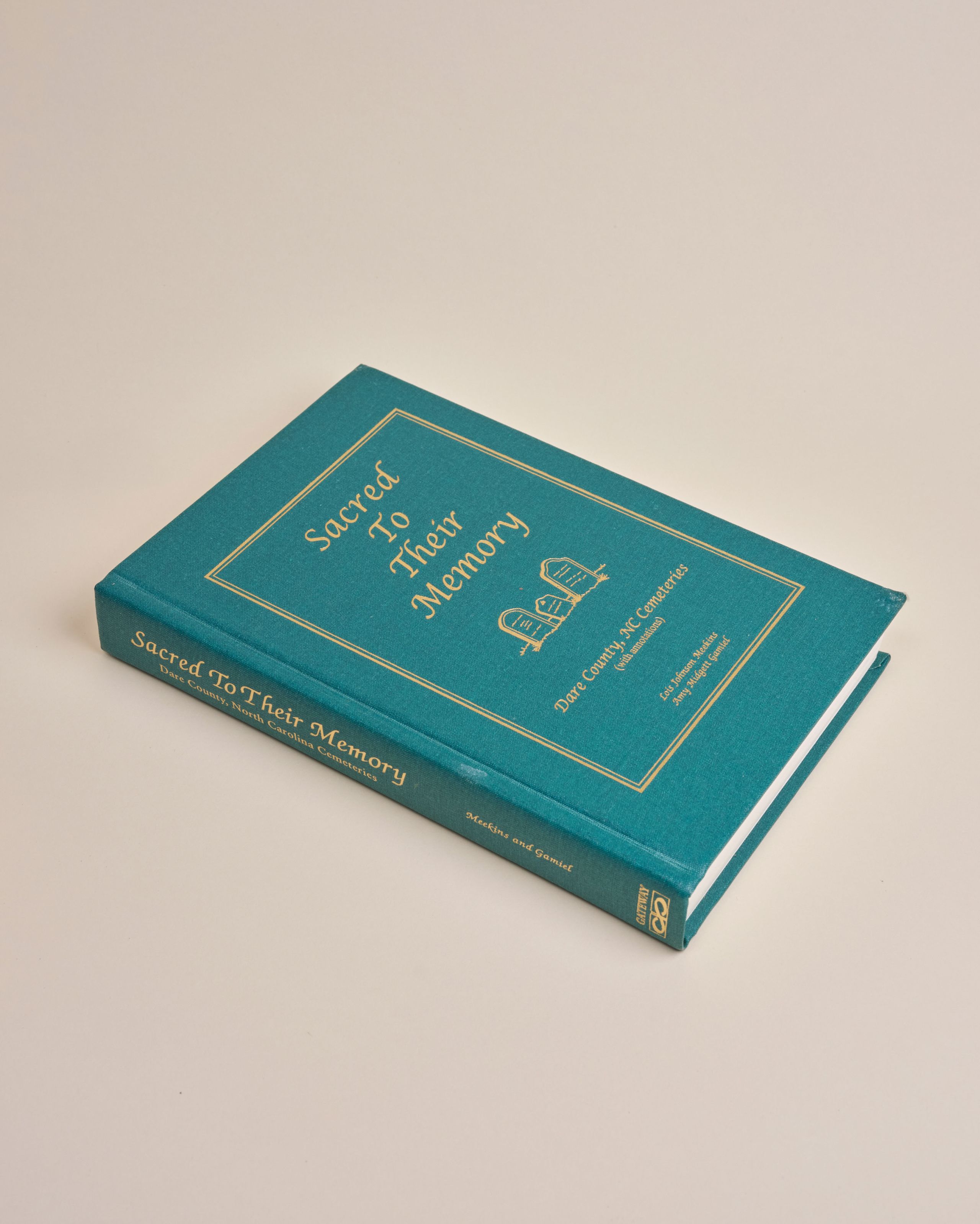
A book of Dare County Cemeteries, one of Jenny Creech’s prized possessions, which she says she would save and take with her if her house were destroyed or flooded during a hurricane and she had to evacuate.
A book of Dare County Cemeteries, one of Jenny Creech’s prized possessions, which she says she would save and take with her if her house were destroyed or flooded during a hurricane and she had to evacuate.

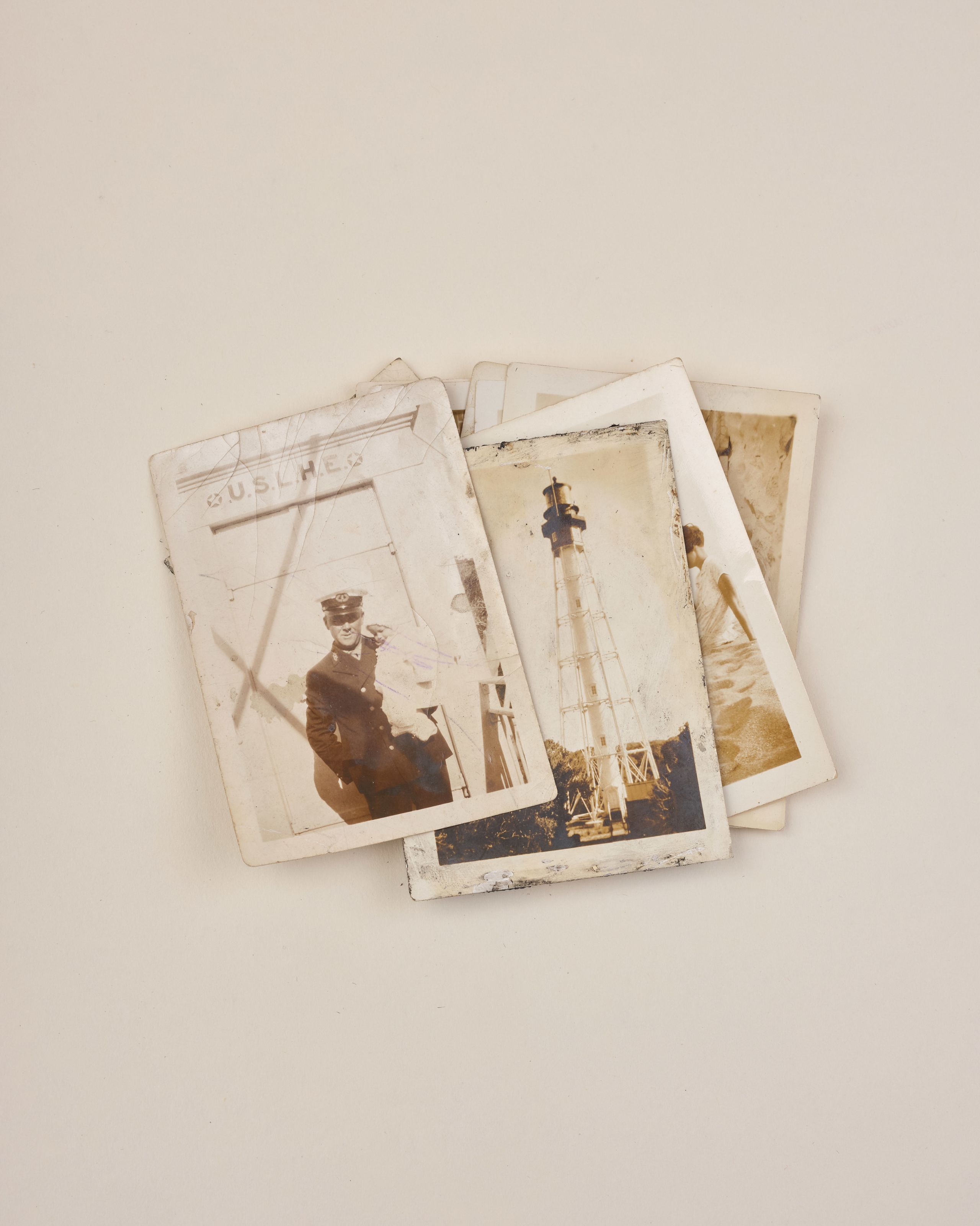
Dawn Taylor's photographs of her great grandfather, Devaney Farrow Jennette, who was a lighthouse keeper at the Cape Fear Lighthouse. Taylor says she would take these photos with her if she had to evacuate Hatteras Island because of a hurricane.
Dawn Taylor's photographs of her great grandfather, Devaney Farrow Jennette, who was a lighthouse keeper at the Cape Fear Lighthouse. Taylor says she would take these photos with her if she had to evacuate Hatteras Island because of a hurricane.
Reimagining the Outer Banks
The good news is that humans can reverse these problems because humans created them. However, Dare County’s proactive, yet undercoordinated patchwork of resilience solutions can only address the symptoms but not the causes of climate change, or the islands’ erosion. Slowing or reversing climate change over the coming centuries will require humans to immediately stop burning fossil fuels and confront the exploitative economies that created this climate crisis. We must switch to clean energies and agricultural methods and develop technology to remove carbon from the atmosphere. Reversing the erosion on the Outer Banks will require North Carolinians to reimagine the tourism and development that wither the islands.
Riggs, the geologist, is adamant that residents should stop building on the oceanfront. We should let the ocean take out the barrier dunes, allow the inlets to open and close naturally, and stop maintaining the highway except within the villages south of Nags Head. This would allow inlets to carry sand into the sounds and build up the soundside beaches, while overwash would build island elevation, he wrote in his book "The Battle for North Carolina’s Coast."
He said that the water quality would improve from the better exchange of water between the ocean and the sounds. Wildlife habitats would flourish, which would benefit fishers and birders, campers and kayakers and a world-class ecotourism industry along the Outer Banks. The higher, more stable island segments could still allow development that is in harmony with the island migration and ecology, he said.
Riggs sees Bald Head Island — only accessible by ferry, with no cars or roads — as a possible model for the Outer Banks’ future. These ferry stations would create jobs from motels, restaurants and other economic development in mainland villages.
“I think that the choice between accommodate or protect or retreat and saying that you pick one of the three, A, B, or C, is overly simplistic,” said Dr. Jessica Whitehead, who was until recently the state's chief resilience officer at the N.C. Office of Recovery and Resiliency. “The reality is that it’s going to be all of the above, and what’s right for any one place is going to be determined by the people who live there.”
Like giving up
Dawn Taylor lives in Avon with her 91-year-old father in her grandparents’ house, the sturdy house her “step grand-daddy” built in 1937 which contains hand-hewn beams he salvaged when the boathouse was demolished at the old Little Kinnakeet Lifesaving Station. Years ago, the home was lifted 12 feet onto pilings to prevent it from flooding during storms.
When Taylor visited the house as a child, she could see the faint beam of the Cape Hatteras Lighthouse outside of her bedroom window as she lay in bed at night. “Instead of counting sheep, I used to count the beam going around and around,” she said.
But in 1999 the lighthouse was moved 2,900 feet inland to keep it from eroding into the sea, which now causes a huge oak tree in her yard to obscure the beam.
“Erosion has taken that childhood experience away from me,” Taylor said.
During an interview over Zoom she sat in her makeshift office at the end of the upstairs hallway. Binders full of historical papers, family research and genealogy charts lined bookshelves behind her.
She thought about running through those halls as a child. She thought about how her adult children want to move away. She thought about her dad dying. She thought about growing older and living alone in that house. She thought about the sea forcing her to leave, uprooting her. It felt like giving up.
Maybe she can keep the house in the family and move inland to a small village like Southport, she wondered. But even some of those inland fishing communities have disappeared into the sea.
She wondered: “Is that my destiny? Is it my people’s destiny?”
And then she cried.
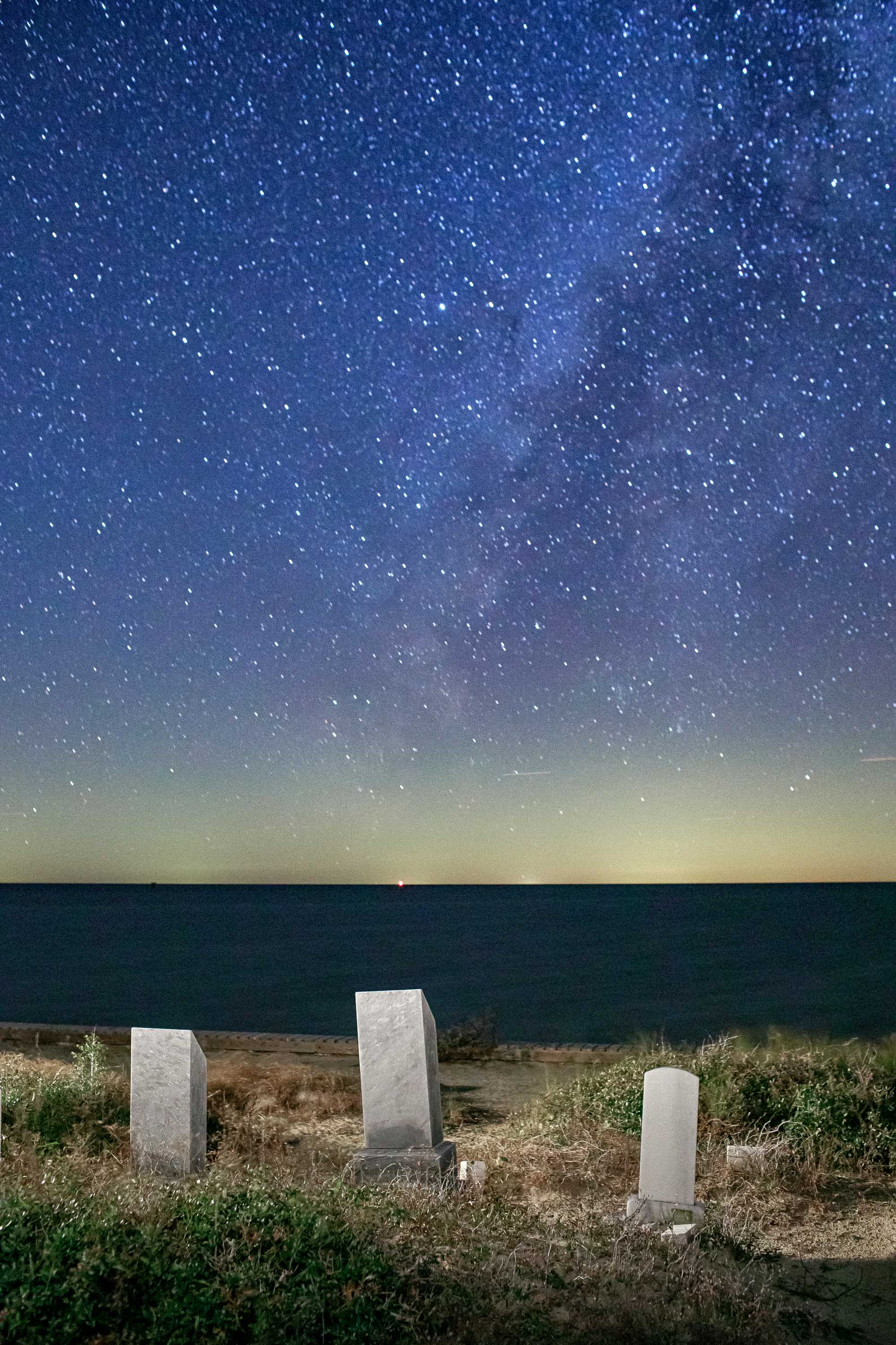
The Milky Way over the Pamlico Sound to the west of the cemetery on a new moon in November 2020.
The Milky Way over the Pamlico Sound to the west of the cemetery on a new moon in November 2020.
Special thanks to Lisa Sorg, who contributed editing to this report. This project was supported by the North Carolina Arts Council, a division of the Department of Natural and Cultural Resources, and Durham Arts Council, local grants administrator.
Justin Cook is a documentary, editorial and commercial photographer and journalist who is based in Durham, North Carolina but works everywhere. His long-term photographic essays tell stories about resiliency in communities living along the edges in America, often by focusing on environmental issues and climate change.
His work has been funded by The Pulitzer Center on Crisis Reporting Connected Coastlines Initiative, The North Carolina Arts Council, The Puffin Foundation, and honored by The Magenta Foundation, Photolucida, POYi, The Society of Professional Journalists, and American Photography. His clients include Duke University, The Guardian, The Marshall Project, The National Audubon Society, The New York Times, National Public Radio, The Simons Foundation, The Trace, VICE, The Wall Street Journal, The Washington Post, and others. When he is not making photographs, you can find him hunting for fossil shark teeth in eastern North Carolina.